Home & Garden
Wintry Mix Forecast for President's Day in Atlanta, North Georgia
And some of the season's coldest temperatures are coming with it.


PEACHTREE CITY, GA -- A very cold arctic airmass will move into Georgia and metro Atlanta on Saturday, bringing some of winter’s coldest temperatures with it on Sunday. And then, the chance for a little more snow or freezing rain.
Temperatures may drop 15-20 degrees below normal, according to the National Weather Service.
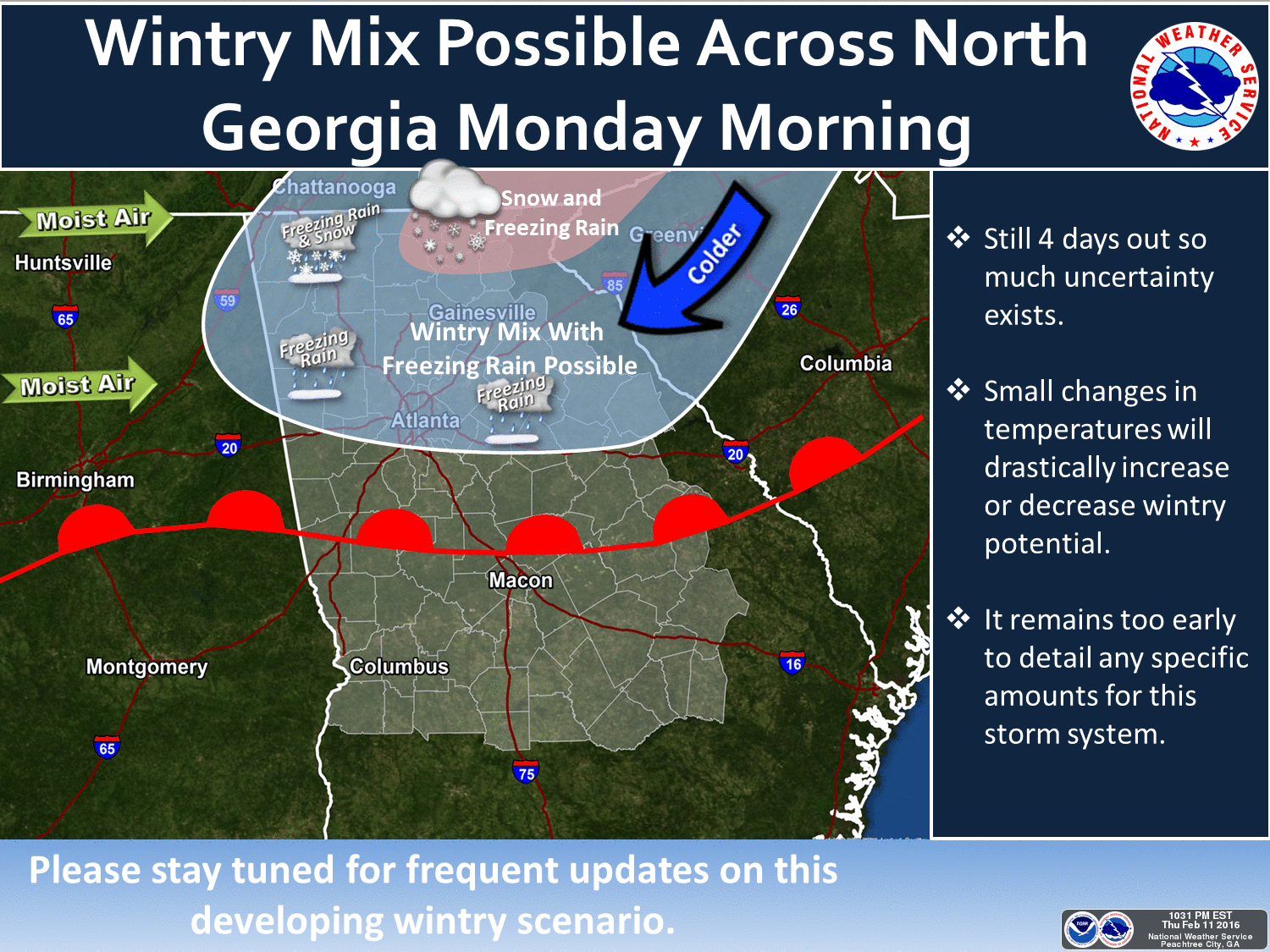
Forecasters says some winter precipitation may arrive Sunday night and into Monday morning. It‘s possible it would be a mix of rain and snow with some freezing rain for much of the area.
Find out what's happening in Midtownwith free, real-time updates from Patch.
The Tuesday forecast is rain for most of the area before the storms move out and leave us dry and warmer, according to the weather service.
Before that, it’s cold. For Friday, highs are forecast to climb into the 50s before dropping into the mid to low 20s on Friday night.
Find out what's happening in Midtownwith free, real-time updates from Patch.
Clear skies are forecast throughout metro Atlanta and north Georgia on Saturday. Highs will be in the upper 30s to mid 40s, but wind chill, or “feels like” temps, aren’t expected to get higher than freezing.
By Sunday morning, the windchill will be down to 14 degrees. Warmer air will begin moving into the area by Sunday afternoon, but not warm enough to avoid that chance of a wintery mix.
Get more local news delivered straight to your inbox. Sign up for free Patch newsletters and alerts.
