Weather
Heavy Downpours, Storms Prompt Flood Watches: Latest NJ Forecast
Storms are hitting New Jersey Friday, with flood watches issued for several counties. Here's the latest forecast:

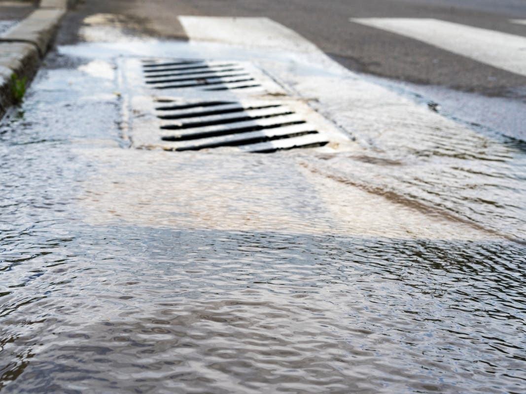
NEW JERSEY — A flood watch has been issued for much of New Jersey, with as much as 4 inches of rain possible Friday into Saturday. Flash flooding is the major concern with these storms, according to forecasters, particularly in urban areas and areas with poor drainage.
Sussex, Warren, Morris, Hunterdon, Somerset, Middlesex, Monmouth, Mercer, Salem, Gloucester, Camden and Burlington counties were issued flood watches as of 6 a.m. Friday through Saturday afternoon.
Flood watches for Bergen, Hudson, Passaic, Union and Essex counties will kick in 12 p.m. Friday and run through 6 p.m. Saturday.
Find out what's happening in Across New Jerseywith free, real-time updates from Patch.
Locally, rainfall totals may reach near 3 to 4 inches, according to the National Weather Service. As of Friday morning, areas of Atlantic and Cape May counties had already reached more than 1.5 inches of rain, exceeding expected predictions.
But this rain is much-needed, as much of the state is "abnormally dry" and some areas even reaching "moderate drought" level, according to the U.S. Drought Monitor.
Find out what's happening in Across New Jerseywith free, real-time updates from Patch.
Roads may become impassable, the National Weather Service warned, especially in the highest risk area in Central Jersey.
Moderate to heavy rainfall is expected through Saturday afternoon, with flooding concerns continuing. It should taper off and skies should clear by late afternoon, the National Weather Service said.
Sunday will get hot again, with highs in the low-to-mid-90s and heat indexes climbing back up, according to forecasters.
"A stray and isolated shower is not out of the question for Sunday and Sunday night," the National Weather Service said, but other than that it should be dry.
Here's the latest forecast.
North Jersey
Friday: Showers likely, with thunderstorms also possible after 11am. Some of the storms could produce heavy rainfall. Cloudy, with a high near 87. Light south wind increasing to 5 to 9 mph in the morning. Chance of precipitation is 70%. New rainfall amounts between a half and three quarters of an inch possible.
Friday Night: Showers and possibly a thunderstorm. Some of the storms could produce heavy rainfall. Low around 74. South wind around 6 mph. Chance of precipitation is 80%. New rainfall amounts between a half and three quarters of an inch possible.
Saturday: Showers and possibly a thunderstorm before 2pm, then a chance of showers and thunderstorms after 2pm. Some of the storms could produce heavy rainfall. High near 87. Southwest wind around 7 mph. Chance of precipitation is 80%. New rainfall amounts between a half and three quarters of an inch possible.
Saturday Night: A 30 percent chance of showers before 8pm. Partly cloudy, with a low around 75. Light and variable wind.
Sunday: Mostly sunny, with a high near 93. Calm wind becoming southwest 5 to 7 mph in the afternoon.
Sunday Night: Mostly clear, with a low around 76.
Central Jersey
Friday: Showers and possibly a thunderstorm. Some of the storms could produce heavy rainfall. High near 84. South wind 5 to 10 mph. Chance of precipitation is 80%. New rainfall amounts between three quarters and one inch possible.
Friday Night: Showers and thunderstorms likely, then showers and possibly a thunderstorm after 11pm. Some of the storms could produce heavy rainfall. Patchy fog. Low around 72. South wind around 5 mph. Chance of precipitation is 80%. New rainfall amounts between a quarter and half of an inch possible.
Saturday: Showers and possibly a thunderstorm before 2pm, then a chance of showers and thunderstorms after 2pm. Patchy fog before 11am. High near 87. Southwest wind around 5 mph. Chance of precipitation is 80%. New rainfall amounts between a quarter and half of an inch possible.
Saturday Night: A chance of showers before 8pm. Patchy fog after 11pm. Otherwise, partly cloudy, with a low around 71. Calm wind. Chance of precipitation is 30%. New precipitation amounts of less than a tenth of an inch possible.
Sunday: Areas of fog before 8am. Otherwise, sunny, with a high near 93. Calm wind becoming west around 5 mph in the afternoon.
Sunday Night: Mostly clear, with a low around 72.
South Jersey
Friday: Showers and possibly a thunderstorm before 3pm, then showers and thunderstorms likely after 3pm. Some of the storms could produce heavy rainfall. High near 84. South wind 5 to 10 mph. Chance of precipitation is 80%. New rainfall amounts between a tenth and quarter of an inch, except higher amounts possible in thunderstorms.
Friday Night: Showers and thunderstorms likely, then showers and possibly a thunderstorm after 11pm. Some of the storms could produce heavy rainfall. Patchy fog. Low around 72. South wind around 5 mph. Chance of precipitation is 80%. New rainfall amounts between a tenth and quarter of an inch, except higher amounts possible in thunderstorms.
Saturday: Showers and possibly a thunderstorm before 2pm, then a chance of showers and thunderstorms after 2pm. Patchy fog before 11am. High near 85. South wind around 5 mph. Chance of precipitation is 80%. New rainfall amounts between a quarter and half of an inch possible.
Saturday Night: A chance of showers before 8pm. Areas of fog after 11pm. Otherwise, partly cloudy, with a low around 70. Calm wind. Chance of precipitation is 30%. New precipitation amounts of less than a tenth of an inch possible.
Sunday: Sunny, with a high near 93. Calm wind becoming west around 5 mph in the afternoon.
Sunday Night: Mostly clear, with a low around 73.
Get more local news delivered straight to your inbox. Sign up for free Patch newsletters and alerts.