Weather
Nor'easter Impacts In Princeton: Snow Total, School Updates
A major storm hit the Princeton Area. Here's the latest

(This post was updated at 6:30 p.m., Monday, Feb. 1.)
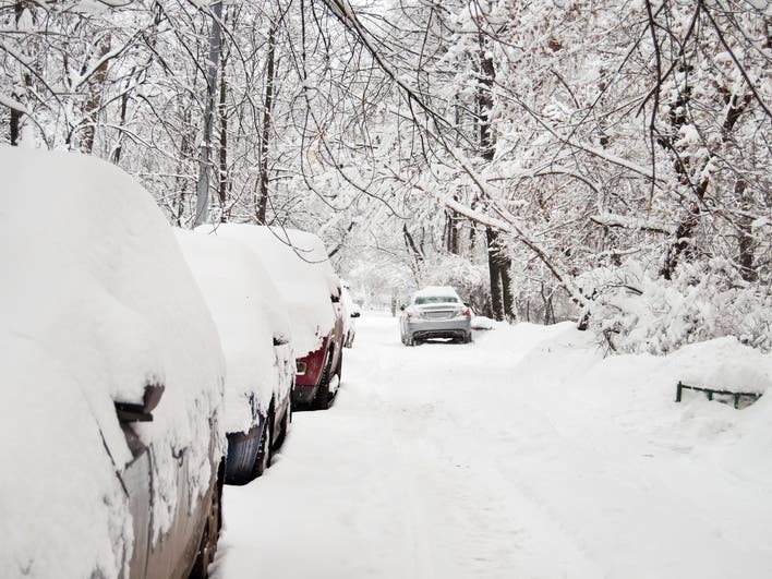
PRINCETON, NJ – A "major" nor'easter hit Princeton area on Sunday, continuing into Monday. As of 4: 30 p.m., Monday Princeton received 8.3 inches of snow.
New Jersey declared a state of emergency, suspended trains and buses and restricted travel on highways. Patch is providing regular updates on the details as well as school closings. Read more: NJ Weather: State Of Emergency, Snow Estimates For NJ Nor'easter
Find out what's happening in Princetonwith free, real-time updates from Patch.
Patch also is providing regular updates on local power outages and snow totals. Read more: Who Got The Most Snow? NJ Town-By-Town Nor'easter Snow Totals
Gov. Phil Murphy said the snowstorm will last longer than expected and could bring more snow, flooding, highway shutdowns and power outages to the state on Monday night and Tuesday.
Find out what's happening in Princetonwith free, real-time updates from Patch.
"Let me say this unequivocally: This is a big one. And it's going to be with us at this point, we think, until tomorrow night," the governor said during a news briefing in Woodbridge on Monday.
Here's what else:
Schools: Princeton Public Schools went virtual on Monday. Schools will be virtual on Tuesday, the district announced Monday afternoon. Schools buildings closed, teachers and staff were asked to work from home because of weather conditions. Updates on Tuesday's schedule will be provided.
Trash and Recycling: Trash and recycling is cancelled for Monday. Recycling collection is now scheduled to Saturday, Feb. 6. Trash collection is tentatively rescheduled for Tuesday. Depending on the severity of the storm, it might be cancelled. Updates on trash collection status will be provided later.
Power: As of Monday, no power outages were reported. If you do experience a power outage, please call:
- PSEG: (800) 436-PSEG (7734) or text "OUT" to 4PSEG (47734)
- JCP&L: (888) -544-4877
- In case of a downed power line, please call the local police department.
The National Weather Service labeled the "major" system a "nor'easter" since it's expected to produce strong, sustained damaging winds and precipitation over a 24-hour period on Monday and into Tuesday.
The storm was expected to be fierce enough to cause power outages and more was expected to arrive overnight and into Tuesday (see the forecast below).
Monday: Snow could be heavy at times. High near 31, with a northeast wind around 20 mph. Gusts high at 35 mph. Chance of precipitation is 100 percent. Total daytime snow accumulation of 7 to 11 inches possible.
Monday night: Snow. Low around 29, with a north wind 15 to 20 mph. Chance of precipitation is 90 percent. New snow accumulation of 2 to 4 inches possible.
Tuesday: Snow likely before 1 p.m. Cloudy, with a high near 34. Chance of precipitation is 60 percent. New snow accumulation of less than an inch possible.
Tuesday night: Chance of possible snow showers and freezing rain before 8 p.m. Then between 8 p.m. and 1 a.m., chance of snow showers . Cloudy, with a low around 25. Northwest wind around 10 mph. Chance of precipitation 30 percent. Snow accumulation less than an half inch possible.
Get more local news delivered straight to your inbox. Sign up for free Patch newsletters and alerts.