Weather
Winter Storm Impact: Princeton Snow Total
Schools, public library remain closed as roads are hazardous to travel. Here's the latest on the winter storm from Princeton.

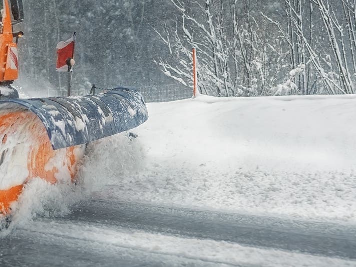
PRINCETON, NJ — According to the latest update, at least 3 inches of snow have fallen in Princeton and roadways are deteriorating as another snowstorm hit Princeton. The latest snow totals, forecast and road impacts have been released now that highway restrictions are in place and COVID vaccine deliveries will be delayed on Thursday (see road impacts, vaccine issues, forecast and snow total estimates below).
Patch is providing town-by-town snow totals. Read more: Who Got The Most Snow? NJ Town-By-Town Snow Totals
Princeton Public Schools are virtual for Thursday and the public library is closed.
Find out what's happening in Princetonwith free, real-time updates from Patch.
Roads are becoming difficult to travel on, and all secondary roads are snow covered.
No power outages were reported in Princeton.
Find out what's happening in Princetonwith free, real-time updates from Patch.
The trash collection has been cancelled for Thursday and will now be picked up on Friday.
Gov. Phil Murphy said the winter weather is causing COVID vaccine "supply chain issues" and that anticipated deliveries will be delayed. He also said three vaccine mega-centers will close on Thursday: Morris, Middlesex and Burington. Bergen County's center will close at 10 a.m.
Murphy said that New Jersey likely has enough supply to handle the delivery delay. "Everybody who wishes to be vaccinated will be," Murphy said.
Murphy also said state offices will be closed and only essential personnel will report for duty. Troopers handled 92 accidents and 55 motorist aids by 9 a.m.
"Mother Nature is making up for lost time," Murphy said.
The National Weather Service issued a winter storm warning for 12 New Jersey counties and a winter weather advisory for the rest of the state.
The NWS says that snow and sleet accumulations could bring anywhere from 3 to 8 inches across the state and make a mess of the Thursday morning commute. More than 1 inch an hour could fall until 2 p.m. on Thursday.
The latest updates show that more snow than expected will fall in Central Jersey, South Jersey and the Jersey Shore, although those areas could also get a significant amount of sleet, freezing rain and ice that could make a mess of roads.
The storm could be a combined snow and ice storm, one that could knock down wires and cause power outages, according to the National Weather Service.
Here's the latest snow totals in Mercer County:
- Trenton 8.0 in
- Hamilton Twp 7.9 in
- 1 SE Robbinsville Twp. 6.7 in
- 2 W Yardville 6.0 in
- Robbinsville Twp. 6.0 in
- Hightstown 4.6 in
- Ewing 4.5 in
- Yardville 2.9 in
- 3 NW Pennington 2.8 in
- Princeton 3 in
Road Impacts:
A speed restriction was imposed on the New Jersey Turnpike in both directions from North of Interchange 7A - I-195 in Robbinsville to North of Interchange 8A - NJ 32 in South Brunswick Twp: 45 miles per hour for Salting Operation.
New Jersey Department of Transportation Commissioner Diane Gutierrez-Scaccetti has issued a commercial vehicle travel restriction on multiple Interstate highways in New Jersey starting at 4 a.m., Thursday, February 18 based on the forecast for heavy snow.
Snow was hitting overnight before the morning commute, with periods of heavy snow forecast during the day. Precipitation is expected to continue through the afternoon commute and into Friday. The travel restrictions are being coordinated with neighboring states.
In addition to the commercial restrictions, all motorists are strongly encouraged to stay off the roads on Thursday. The safest place to be is at home.
The commercial vehicle travel restriction will begin at 4 a.m., Thursday, February 18 and will be in place until further notice for the following highways in both directions:
· I-78, from the Pennsylvania border to I-95 (New Jersey Turnpike)
· I-80, from the Pennsylvania border to I-95 (New Jersey Turnpike)
· I-195, from I-295 to NJ Route 138
· I-280, from I-80 to I-95 (New Jersey Turnpike)
· I-287, from NJ Route 440 to the New York State border
· I-295, from Exit 60 (I-195) north to the Scudders Falls Bridge (Pennsylvania border)
· NJ Route 440, from the Outerbridge Crossing to I-287
The commercial vehicle travel restriction applies to:
· All tractor trailers (exceptions as listed in the Administrative Order)
· Empty straight CDL-weighted trucks
· Passenger vehicles pulling trailers
· Recreational vehicles
· Motorcycles
This restriction DOES NOT apply to:
· The New Jersey Turnpike
· The Garden State Parkway
· The Atlantic City Expressway
· I-76
· I-676
· Public safety vehicles, sworn and civilian public safety personnel; as well as other personnel directly supporting healthcare facilities or critical infrastructure such as providing fuel or food.
For a complete list of operations or personnel that are exempt from the travel ban, see the Administrative Order.
Trucks that are already in New Jersey when the travel restrictions go into place are encouraged to pull off in truck stops to wait out the storm – DO NOT PARK ON SHOULDERS.
Here is the forecast:
Thursday: Snow before 1 p.m., then snow and sleet between 1 p.m. to 4 p.m. Sleet after 4 p.m. High near 28. Chance of precipitation is 100 percent. Total daytime snow and sleet accumulation of 6 to 10 inches possible.
Thursday Night
Snow and sleet possible, becoming all snow after 9 p.m. Cloudy, with a low around 26. Chance of precipitation is 70 percent. New snow and sleet accumulation of less than one inch possible.
Friday
Snow before 2 p.m., then rain and snow likely. Cloudy, with a high near 34. Chance of precipitation is 70 percent. New snow accumulation of around an inch possible.
Friday Night
Cloudy, then gradually partly cloudy, with a low around 23.
Thank you for reading. Have a correction or news tip? Email [email protected]
Get breaking news alerts on your phone with our app. Download here. Sign up to get Patch emails so you don't miss out on local and statewide news
Get more local news delivered straight to your inbox. Sign up for free Patch newsletters and alerts.