Weather
Snow In Mercer Island Monday Morning: National Weather Service
Forecasts indicate some areas around Puget Sound may get up to 1 inch on Monday morning.

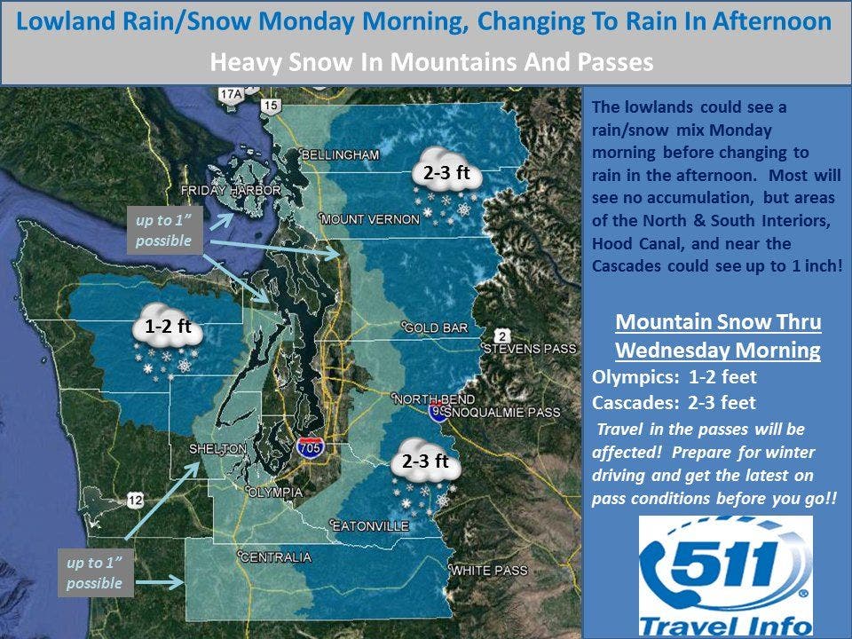
The National Weather Service is forecasting snow for the Puget Sound region on Monday morning. The forecasts indicate some areas could get up to 1 inch, although any accumulation should wash away by the afternoon as precipitation turns over to rain.
Cities closer to the Cascades, like Enumclaw and Issaquah, are have the best chances of seeing measurable accumulation. In areas closer to the sound, there may not be any accumulation, and precipitation will fall as a rain/snow mix.
Lowland #rain/#snow Mon morn, rain by aftn; some could see 1" of snow. Hvy snow will affect Mntns & Passes. #Windy Mon aftn & night. #wawx pic.twitter.com/E5pXW08qcF
— NWS Seattle (@NWSSeattle) December 26, 2016
A bigger concern is snow in the mountains. The same system that will bring snow to the lowlands could dump several feet in the mountains. The National Weather Service has issued a winter storm watch for the mountains, and is predicting up to three feet to fall in the Cascades through Wednesday. One to two feet is expected in the Olympics.
Find out what's happening in Mercer Islandwith free, real-time updates from Patch.
Snow levels will be down around 2,000 feet for the duration of the storm, so all passes through the Cascades will be affected. The storm is expected to swing through the mountains beginning Monday afternoon.
Image via National Weather Service
Find out what's happening in Mercer Islandwith free, real-time updates from Patch.
Get more local news delivered straight to your inbox. Sign up for free Patch newsletters and alerts.