
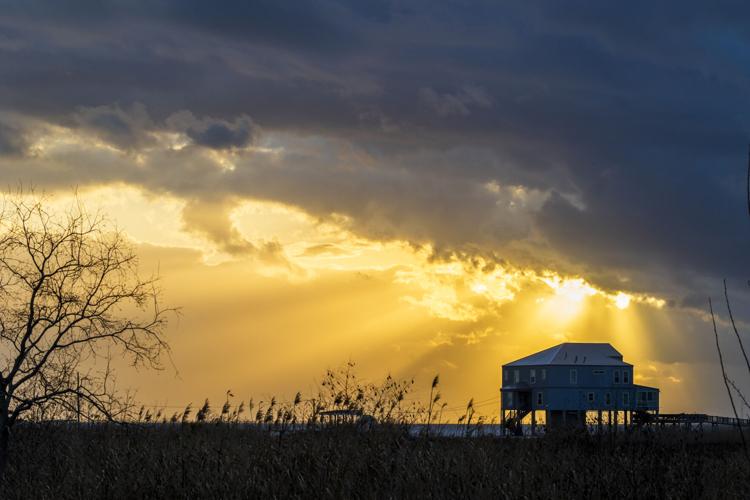


The window in Milton Dudenhefer’s kitchen, far out on the fringes of New Orleans, frames a waterfront landscape fit for a painting.
Dudenhefer, 85, has lived here for decades, watching the thick expanse of marsh next to his house slowly disappear, giving way to the tides of Lake St. Catherine. He moved to this remote eastern stretch of the city commonly called “the island” after he and his late wife agreed it would be the perfect fit.
“I said, ‘I’d as soon live in a camp,’” the retired commercial fisherman remembered as he stood in the kitchen of his house raised high above the lake, reminiscing about their conversation in 1962. “And she said, ‘I’m the same way. I’ve always loved being around the water.’”

Milton Dudenhefer in front of his home along Lake St. Catherine near The Rigolets in eastern New Orleans on Thursday, February 23, 2024. (Photo by Chris Granger, The Times-Picayune)
Life is so distant on the nine-mile island that many urbanites may not even realize it’s part of the city, a tiny world unto itself that generations of New Orleanians have either called home or used as a weekend getaway, casting fishing lines and tossing crab nets from docks.
But, like so much of Louisiana’s coast, the ground beneath it is being swept away. The difference here is that the island and the marshy land that surrounds it – despite its relatively modest value -- is some of the most important property in the entire New Orleans region.
That’s because it’s part of the wider landbridge dividing three lakes, and if that disappears, the heavily populated areas beyond it will be hit with far greater storm surge. The ecology of Lake Pontchartrain would also drastically change forever, with little to slow the salty tides tumbling in from the Mississippi Sound and Gulf of Mexico.
The concern is real. One state project rebuilding the drowning marsh in a few locations near Dudenhefer’s house is set to wrap up soon, but money is not in place for a bigger, sweeping plan to address the entire landbridge, which could cost around $1 billion.
Years ago, Dudenhefer would only be able to see the tops of shrimp trawlers from his house as they navigated nearby, the marsh thick enough to hide their hulls. Now he gets a full view.
“I had oyster beds out there, and when you mark the oyster beds, you come back the following year, the poles that you got on shore are now 20 feet off the shore,” he said, speaking of the damage hurricanes have done to the marsh.
Tropical storms have been a particular source of land loss. Intensified hurricanes and sea level rise due to climate change will worsen the problem.

‘Da Camp’
The island, officially known as the Lake St. Catherine neighborhood, is among the most unique parts of New Orleans – and has seen its share of history.
Situated on the narrow strip between Lake Pontchartrain and Lake St. Catherine, it is outside the New Orleans levee and floodwall system. U.S. 90, or Chef Menteur Highway, runs through its spine. But the area and its principal artery lost their commercial luster after the interstates were built.

An old bridge crosses Chef Menteur Pass on Highway 90 in eastern New Orleans on Thursday, February 23, 2024. (Photo by Chris Granger, The Times-Picayune)
The island moniker is not just a reference to the area’s remoteness; it’s also literally true. To the southwest, it is separated from the mainland by Chef Pass; to the northeast, by the Rigolets. The old 1929 swing bridge that crosses Chef Pass is a throwback to another era, the drive over it not unlike entering a time machine.
At one end of the island is The Tally Ho Club, founded in 1815, which describes itself as the oldest operating hunting and fishing club in the country. Guests there have included Teddy Roosevelt, says club historian Ned Hemard.
The crumbling remnants of Fort Pike, built in the 1820s and now gradually slipping into the water, are on the opposite end, below a far newer bridge crossing the Rigolets. In between is the spot where Hollywood star Jayne Mansfield was killed in a car accident in 1967.
Signs along Chef Highway note the names of camps, ranging from the kitschy and comedic to simple yat speak: “Pier Pressure,” “Fish Tales,” “Camp Big Shot,” “Gaileforce,” “Da Camp,” and on and on.
There are still steps leading to nowhere in spots, reminders of Hurricane Katrina's wrath, the storm having destroyed the buildings connected to them. The priest at the island’s St. Nicholas of Myra Catholic Church chose to ride out the storm there and did not survive.

Only the steps remain to a home that was once located on the tiny "island" located in eastern New Orleans between Lake Pontchartrain and Lake Borgne on Thursday, February 23, 2024. (Photo by Chris Granger, The Times-Picayune)
Roy Vinot has spent his life on the property just next to the fort, taking the bus into the heart of the city for school when he was a kid. His dad, Warren, born on the opposite side of the island, moved to Vinot’s current spot in 1933 with his family and later ran the restaurant, gas station and early iteration of Vinot’s Marina.
Vinot, 70, now commutes to the marina from his home in Mississippi, but his ties to the island remain strong. He points to where his dad’s house used to be on the property and shows off a picture in his office of the former gas station, a Jax beer sign hanging out front. In another, his dad poses next to a giant tarpon during a rodeo the marina organized.
In keeping with the go-it-alone attitude many on the island retain, Vinot does the work on his marina himself, including on the boat slips he rents. It has gone through various incarnations, with storms repeatedly wrecking it. Vinot also ran a boat building shop there until Katrina took out the walls. He, too, has watched the marsh across from his marina drastically vanish.
His first job, at 16, was working next door at Fort Pike. It’s unlikely the fort will be restored anytime soon, if ever. The historic site, built atop a cypress log structure, is in such disrepair that it would take lots of money and expertise to even devise a plan, says Raymond Berthelot, a historic site district manager for the state.

A map of The Rigolets in the office of Roy Vinot at Vinot's Marina in eastern New Orleans on February 22, 2024. (Photo by Chris Granger, The Times-Picayune)
Vinot counts that among the many changes on the island over the decades.
“They had ballrooms and restaurants and everything else,” he said of the pre-interstate days. “Best seafood in the world. You can’t get seafood like that anymore. You’d have stuffed crab and it’d be stuffed crab – I mean the best stuffed crab on earth.”
Reliable population figures for the island are hard to find. Kirk Lee Jacobs, an island resident and chief of the Fort Pike Volunteer Fire Department – the only volunteer fire department in the city – points out a significant number of camps there are short-term rentals.
For permanent residents who do remain, Jacobs advocates for two issues in particular: a new bridge over Chef Pass and less bureaucratic red tape for those seeking to fill in and build on their properties.

Old photos of better times where Vinot's Marina is now located long Lake St. Catherine in The Rigolets area of eastern New Orleans on Thursday, February 23, 2024. (Photo by Chris Granger, The Times-Picayune)
‘Critical landform’
Zooming out to take in the entire landbridge reveals the precariousness of it all. The chunk of land in easternmost New Orleans that includes the island serves as a divider between Lake Pontchartrain and Lake Borgne, with Lake St. Catherine carved out in between.
The underlying geography is in itself a fascinating story, explains Tulane geographer Richard Campanella. Sand from the Pearl River formed a barrier island around 5,000 years ago, later buried by sediment from the Mississippi River when it shifted east. The current island was formed when tides broke through at Chef Pass and the Rigolets.
Native Americans initially inhabited the area, then European settlers.
“Heading out to the region on the Old Gentilly Road in the mid-1800s, you would have found small plantations and farmsteads along a slight ridge, but once you crossed Chef Menteur Pass, fishing and hunting prevailed,” Campanella says.
Efforts to preserve the landbridge have long been on the state’s radar. It is considered “a critical landform of coastal Louisiana,” said Joseph Wyble, project manager for the state’s Coastal Protection and Restoration Authority.
One large section, from the island’s Hospital Road in the north to Greens Ditch about two-thirds of the way down, has lost about 110 acres of marsh since 1956, or more than 80 football fields, said Wyble. Other areas of the landbridge have also seen dramatic change.
It was for that reason that the area was selected as part of a federal program that has allowed marsh restoration in three spots on the landbridge, totaling 283 acres, at a cost of around $25 million. Work is due to wrap up in the weeks ahead.

Roy Vinot stands in the doorway to his bait and ice shop, Vinot's Marina, as he watches boats pass in eastern New Orleans near The Rigolets. The channel marker, far left, is where his land used to reach when he was a child growing up in this area. Erosion and subsidence have shrunk this land over time. (Photo by Chris Granger, The Times-Picayune)
The federal government foots 85% of the bill and the state the rest. Like most such marsh restoration projects, it is designed for a 20-year lifespan. Additional work on the landbridge under the same program could begin in the next year or so, Wyble said.
A broader vision would address 29,000 acres of the landbridge and nearby portions of St. Tammany – at a cost of around $1 billion or more.
“That landbridge provides a storm-surge reduction benefit for not just New Orleans, but all the communities on the interior side of Lake Pontchartrain for a storm that's approaching from an eastward direction,” Wyble said.
‘Fished oysters, shrimped, raised kids’
Dudenhefer knows the island and the waters surrounding it as well as anyone. He has worked as a commercial shrimper, crabber and oysterman, as well as a truck driver. At times his wife Bernadette, who went by her nickname Ms. Red, would help out on the boat.
Later, after their two sons were born, Red operated an icehouse and dock next to their house. They would supply shrimpers with ice and buy shrimp from them.

Milton Dudenhefer stands near his old bait well behind his house along Lake St. Catherine near The Rigolets in eastern New Orleans on Thursday, February 23, 2024. (Photo by Chris Granger, The Times-Picayune)
Their first house, built in 1962, was damaged by Hurricane Betsy a few years later, but they rebuilt. They lost the icehouse and the house in Katrina. The house was rebuilt again.
“Me and her, we did everything together – fished oysters, shrimped, raised kids,” Dudenhefer said of his wife, who died a couple years ago.
They were married when he was 18 and she was 19, having both grown up in Little Woods, another historic New Orleans waterfront community. They also bought property in Mississippi where Red kept her horses, one of her passions.
Dudenhefer still has a boat, and he still works around the house. He has a deep knowledge of issues related to the coast, having worked and lived along it his entire life. He points out the lack of sediment replenishing the marsh from the Mississippi River, now held in place by levees.
Asked about whether he believes the island will eventually disappear, he says at least there’s awareness of the problem now. Earlier on, he said it seemed difficult to convince people not witnessing it of the magnitude of the erosion and subsidence occurring.
“People are starting to realize what's going on,” he said. “You know, the commercial fishermen were busy making a living and didn’t have time to make all these meetings, and they were the ones that really knew what was going on. And they finally got some people to start listening.”


