
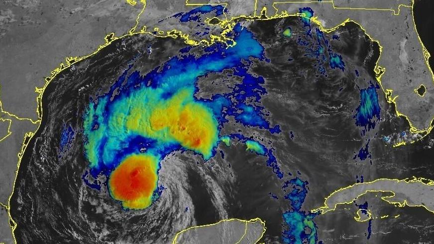


After pummeling the Yucatan Peninsula, Tropical Storm Beryl emerged over the Gulf of Mexico on Friday and is expected to regain hurricane strength before making landfall on the Texas coast early next week, forecasters with the National Hurricane Center in Miami said Saturday.
Though forecasters called the once Category 5 storm a "shadow of its former self," Beryl is still expected to bring damaging hurricane-force winds and life-threatening storm surge in parts of northeastern Mexico and the Texas coast and create urban flooding across parts of Texas.
Beryl's maximum sustained wind speed was at 60 mph as of Saturday morning. The storm is forecast to intensify some Sunday in the very warm waters of the Gulf before making landfall on Monday.
Parts of Louisiana are expected to see a couple inches of rain in connection with the storm, and areas of the southwest Louisiana coast could see flooding, according to local forecast offices. But the state likely won't see any direct impacts.
A hurricane watch is in effect for the Texas coast from the mouth of the Rio Grande River northward to San Luis Pass.

Local forecasts
Texas will take the brunt of Beryl as it makes landfall in the U.S., and Louisiana could still see some rain associated with the system.
NHC forecasts show areas of southwest Louisiana have a 5% chance of seeing sustained winds over 39 mph over the next two days.
Forecasters with the National Weather Service in Lake Charles say additional moisture from Beryl could create heavy rainfall for the area and coastal flooding will be possible for the southwest Louisiana coast on Monday morning.
Beryl's arrival in Texas will also leave southeast Louisiana, including Baton Rouge and New Orleans, feeling hot, humid and rainy, according to the NWS office in New Orleans.
The storm could leave behind a trough somewhere over Louisiana by midweek, forecasters said.
