RAIN PAIN
UK weather: Brits face weekend washout with MORE rain as Met Office warns Atlantic air to bring plunge in temperatures
Rain is coming and conditions are expected to be 'unsettled'


BRITS can expect a weekend washout after a period of pleasant weather as the Met Office warns as Atlantic air ushers in cooler temperatures.
The cooler air is being brought in by a “strong westerly jet stream,” according to the forecaster.

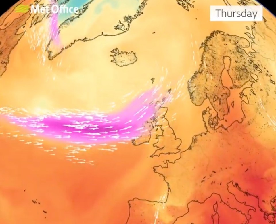
The Met Office said in a post on X, formerly Twitter: “Turning cooler as a strong westerly jet stream (marked in pink) brings cooler air from the Atlantic across the UK.
“The weather will turn unsettled too with areas of rain crossing the UK over the next few days.”
The attached footage to the post shows the cooler air hitting Northern Ireland and western and northern parts of Scotland later today but building strength tomorrow.
It also moves south covering southern Scotland, northern England and parts of north Wales.
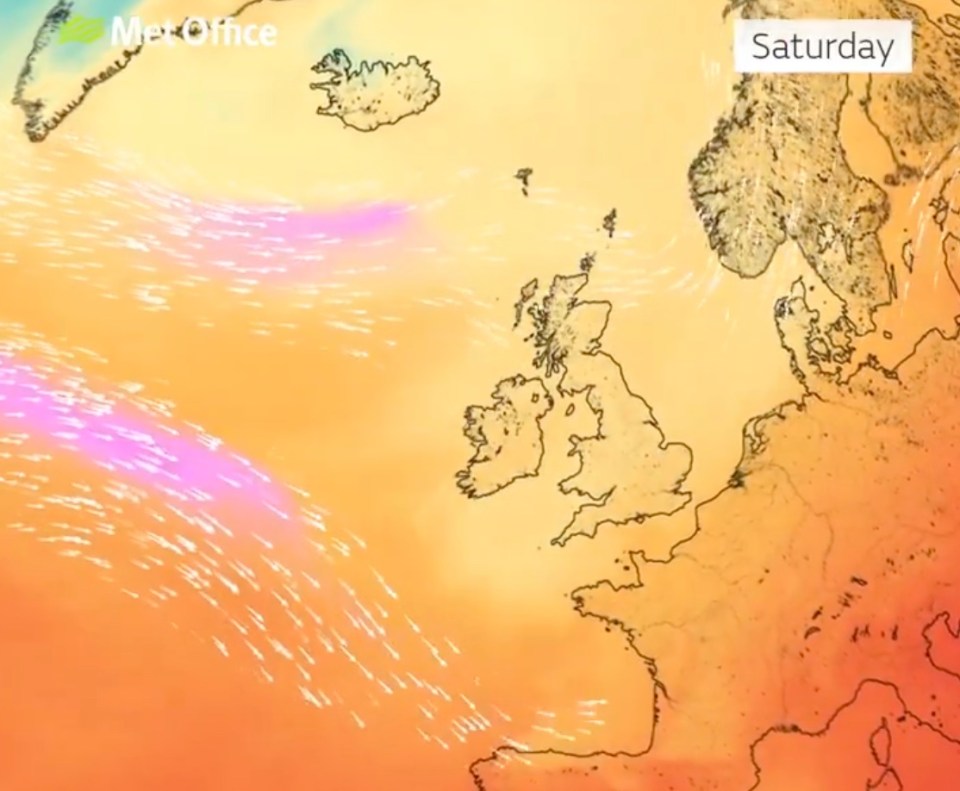
By Saturday it splits in two with a small band heading just north of mainland Scotland while a larger pocket heads towards Spain.
Before that though, it will be mostly a fine and dry day with spells of sunshine although it is predicted to turn cloudy and windy later in the far northwest.
Central and eastern England though can expect some cloudy conditions along with some patch rain and drizzle but it will brighten up later on.
Overnight though rain and strong winds will spread across large part of Scotland, Northern Ireland and parts of England.
Elsewhere it will be dry with clear spells and it will feel fresher than the last few days.
On Thursday, rain across the north will slowly spread southwards as the day wears on.
However, southern and central areas will remain fine and dry throughout.
Conditions will brighten up in Scotland and Northern Ireland later on.
There will be rain at first in the southeast on Friday, otherwise largely dry and bright with some showers in the west.
From the Met Office - August 18 to 27
A mobile westerly pattern is expected to continue over the weekend and into next week.
Low pressure systems will track eastwards, probably near to the north of Scotland, with associated frontal zones periodically moving east over the country.
This means cloud and rain will move in from the west at times, occasionally accompanied by breezy conditions and the possibility of unseasonably windy spells.
Either side of weather fronts there will be spells of sunny or clear weather.
Most of the wet weather will tend to be focused in the west and northwest, with longer drier spells further south and east.
Temperatures overall will be close to average for August.
There is just a chance of short-lived very warm conditions returning to parts of the south and east at times.