Category:SVG labeled maps of administrative divisions of Saudi Arabia (location map scheme)
Jump to navigation
Jump to search


.svg)


_(Paris_zoom).svg)
.svg)
,_administrative_divisions_-_de_-_colored_(multizoom).svg)
_-_colored.svg)
.svg)
,_administrative_divisions_-_Nmbrs_(multizoom).svg)
,_administrative_divisions_-_de_-_colored.svg)
_-_de_-_colored.svg)

.svg)

.svg)
Media in category "SVG labeled maps of administrative divisions of Saudi Arabia (location map scheme)"
The following 10 files are in this category, out of 10 total.
-
 Saudi Arabia Administrative Divisions - AR.svg 720 × 600; 615 KB
-
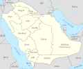
 Saudi Arabia Administrative Divisions - EN.svg 720 × 600; 623 KB
-
 Saudi Arabia, administrative divisions - ar - colored.png 720 × 600; 158 KB
-
 Saudi Arabia, administrative divisions - de - colored.svg 1,802 × 1,501; 512 KB
-
 Saudi Arabia, administrative divisions - de - monochrome.svg 1,802 × 1,501; 537 KB
-
 Saudi Arabia, administrative divisions - et - colored.svg 1,802 × 1,501; 457 KB
-
 Saudi Arabia, administrative divisions - Nmbrs - colored.svg 1,802 × 1,501; 500 KB
-
 Saudi Arabia, administrative divisions - Nmbrs - monochrome.svg 1,802 × 1,501; 503 KB
-
 Saudi Arabia, administrative divisions - th - colored.svg 1,802 × 1,501; 736 KB
-
 Saudi Arabia, administrative divisions - th - monochrome.svg 1,802 × 1,501; 622 KB


