Category:SVG labeled maps of administrative divisions of Senegal (location map scheme)
Jump to navigation
Jump to search


.svg)


_(Paris_zoom).svg)
.svg)
,_administrative_divisions_-_de_-_colored_(multizoom).svg)
_-_colored.svg)
.svg)
,_administrative_divisions_-_Nmbrs_(multizoom).svg)
,_administrative_divisions_-_de_-_colored.svg)
_-_de_-_colored.svg)

.svg)

.svg)
Media in category "SVG labeled maps of administrative divisions of Senegal (location map scheme)"
The following 9 files are in this category, out of 9 total.
-
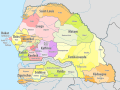
 Senegal, administrative divisions - de - colored.svg 1,266 × 954; 498 KB
-
 Senegal, administrative divisions - de - monochrome.svg 1,266 × 954; 498 KB
-
 Senegal, administrative divisions - en - monochrome.svg 1,265 × 930; 10.7 MB
-
 Senegal, administrative divisions - et - colored.svg 1,266 × 954; 367 KB
-
 Senegal, administrative divisions - mk - monochrome.svg 1,266 × 954; 538 KB
-
 Senegal, administrative divisions - Nmbrs - colored.svg 1,266 × 954; 498 KB
-
 Senegal, administrative divisions - Nmbrs - monochrome.svg 1,266 × 954; 499 KB
-
 Senegal, administrative divisions - th - colored.svg 1,266 × 954; 589 KB
-
 Senegal, administrative divisions in colour 2.svg 1,264 × 947; 813 KB


