User:Gabrielsanz
Jump to navigation
Jump to search
Subjects
- Geography
- Ethnography
- Climatology
- Maps
Contact info Please visit: Gabriel Sánchez-Dávila
Contributions
[edit]
|
All map images in this gallery could be re-created using vector graphics as SVG files. This has several advantages; see Commons:Media for cleanup for more information. If an SVG form of this image is available, please upload it and afterwards replace this template with
{{vector version available|new image name}}. |
Ethnic maps of Venezuela
[edit]_population_proportion_map.png)
Moreno (Mestizo) population of Venezuela in 2011.

White population of Venezuela in 2011.

Amerindian population of Venezuela in 2011.

Black and Afrodescendant population of Venezuela in 2011.
Köppen climate maps of South America
[edit]
Köppen climate maps of Venezuela, geographic/natural regions
[edit]-
 Cordillera de Merida (Venezuelan Andes)
 -
 Sierra de Perija (Venezuelan Andes)
 -
 Central section (Venezuelan Coastal Range) / Tramo Central (Cordillera de La Costa)
 -
 Eastern section (Venezuelan Coastal Range) / Tramo Oriental (Cordillera de La Costa)
 -
 Guayana
 -
 Los Llanos
 -
 Maracaibo Lowlands / Depresión del Lago de Maracaibo
 -
 Orinoco Delta
 -
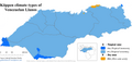
 Coriano System


Maps of climate zones according thermal floors of Venezuela
[edit]-
 Climate Zones
 -
 Pisos Térmicos


Maps of temperature regime of Venezuela
[edit]-
 Temperature Regime

Geographic/Natural regions of Venezuela
[edit]-
 Natural regions / Regiones naturales
 -
 Andes Venezolanos / Venezuelan Andes
 -
 Cordillera de La Costa / Venezuelan Coastal Range
 -
 Delta del Orinoco / Orinoco Delta
 -
 Depresión del Lago de Maracaibo / Maracaibo Lowlands
 -
 Sistema Coriano / Coriano System
 -
 Guayana / Guiana
 -
 Insular
 -
 Los Llanos
.png)


Population density of Venezuela
[edit]-
 Population density of Venezuela by parroquias (parishes) according the results of 2011 Census. Yellow tones denote an urban area of the parish.
