
The country’s government is relocating to a brand-new city in the desert outside of Cairo.

The powerful storm triggered landslides, power outages, and flooding in southern parts of the country.

The setting for John Henry’s legendary contest with a steam-powered drill may have been this tunnel through Big Bend Mountain in West Virginia.
Published Sep 2, 2024
Smooth beaches meet rugged alpine terrain along this section of coastline in southwestern Italy.
Published Sep 1, 2024
An array of satellite sensors observed the long-duration, episodic spread of the state’s historic fire.
Published Aug 31, 2024
The 56-foot wave in Pedersen Lagoon, on Alaska’s Kenai Peninsula, damaged trees and left a mark on the landscape.
Published Aug 28, 2024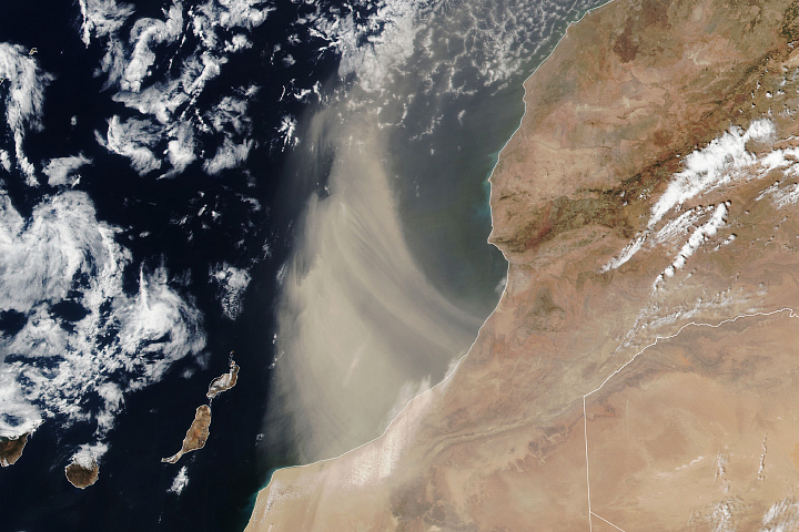
Desert winds kicked up a cloud of dust from northern Africa.
Published Aug 27, 2024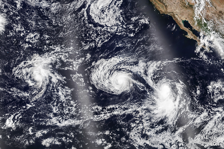
Hurricane Hone brought soaking rains to Hawaii when it passed south of the island chain, and more storms brewed to the east.
Published Aug 26, 2024
In summer 2024, NASA scientists went to northern Greenland to study how clouds and atmospheric particles may be contributing to the ongoing loss of multiyear sea ice.
Published Aug 26, 2024
Urban and agricultural landscapes abut the U.S.–Mexico border in this part of the Sonoran Desert.
Published Aug 25, 2024
Land surface temperatures rise and fall with the heat of the Sun, and they represent how hot or cold the surface would feel to touch. These maps show daytime land temperatures as measured from space.

What do you do when presented with a new satellite image? Here's what the Earth Observatory team does to understand the view.
Published Nov 18, 2013
NASA satellites document how our world—forests, oceans, human landscapes, even the Sun—changes over months, seasons, and years.
Published Apr 29, 2009
Excerpts from a scientist's emails home to family provide a glimpse of what life was like on one of the world’s most northern scientific outposts in the world.
Published Aug 23, 2024
Researchers trekked to Alaska’s Valley of Ten Thousand Smokes to better understand the icy volcanic landscapes on Earth, Mars, and beyond.
Published Aug 22, 2024

Sea salt, volcanic ash, dust, wildfire smoke, and industrial pollution are types of airborne aerosols. Natural aerosols tend to be larger than human-made aerosols. These maps show when and where aerosols come from nature, humans, or both.

These maps depict anomalies in land surface temperatures (LSTs); that is, how much hotter or cooler a region was compared to the long-term average. LST anomalies can indicate heat waves or cold spells.
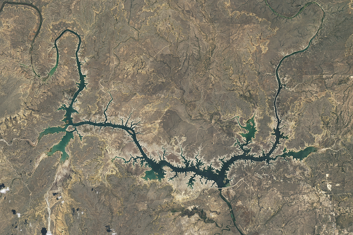
Amid drought in southern Texas and northern Mexico, Amistad Reservoir has hit record-low levels.
Published Aug 22, 2024
The sport can be played on Earth’s distinctive green courses, such as those around Chicago, and even on the Moon’s gray soil.
Published Aug 22, 2024
Heat and wind gusts helped the blazes spread through over 5,700 hectares of forest.
Published Aug 20, 2024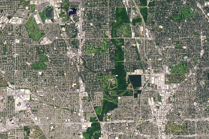
Every month on Earth Matters, we offer a puzzling satellite image. Your challenge is to use the comments section to tell us where it is, what we are looking at, and why it is interesting.
Published Aug 13, 2024
Have you ever wondered what it would be like to live in a different part of the world? What would the weather be like? What kinds of animals would you see? Which plants live there? By investigating these questions, you are learning about biomes.
Published Aug 28, 2020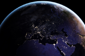
Satellite images of Earth at night have been a curiosity for the public and a tool of fundamental research for at least 25 years. They have provided a broad, beautiful picture, showing how humans have shaped the planet and lit up the darkness.
Published Apr 12, 2017
12 months of high-resolution global true color satellite imagery.
Published Oct 13, 2005
Hurricane season in the basin runs from June 1 to November 30.
Published Jul 1, 2024
People have developed systems to harvest and store energy from sources such as wind, sunlight, and tidal action. Many of these installations are visible from orbit.
Published May 10, 2024
From ground-level ozone to particulate matter to nitrogen dioxide, an array of gasses and particles can affect the air people breathe, with implications for human health.
Published Apr 8, 2024
Warmer-than-average temperatures are showing up locally and globally, with consequences for people, landscapes, and ecosystems.
Published Mar 26, 2024
These maps depict how much hotter or cooler an ocean basin was compared to the long-term average. Temperature anomalies can indicate changes in ocean circulation or the arrival of patterns like El Niño and La Niña.

Whether sparked by lightning, intentional land-clearing, or human-caused accidents, wildland fires are burning longer and more often in some areas as the world warms.
Published Feb 27, 2024
Airborne aerosols can cause or prevent cloud formation and harm human health. These maps depict aerosol concentrations in the air based on how the tiny particles reflect or absorb visible and infrared light.

Warmer-than-average temperatures are showing up locally and globally, with consequences for people, landscapes, and ecosystems.
Published Aug 15, 2023


