
User:Mattximus/sandbox8


New Jersey is a state located in the [Northeastern United States|Northeastern]] United States. According to the 2010 United States Census, New Jersey is the 11th most populous state with 8,791,936 inhabitants but the 5th smallest largest by land area spanning 7,354.22 square miles (19,047.3 km2).[1] New Jersey is divided into 21 counties and contains 565 municipalities consisting of five types: 254 boroughs, 52 cities, 15 towns, 241 townships, and 3 villages. The largest municipality by population in New Jersey is Newark with 277,140 residents whereas the smallest is Tavistock with 5 residents.[1]
List of municipalities
[edit]- Largest municipalities in New Mexico by population
-
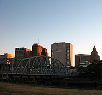 Newark, largest city in New Jersey
 -

-
-
-
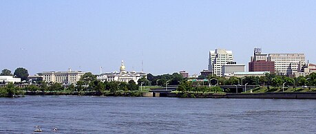 Trenton, Capital of New Jersey
 -


