


Texas wildfires fueled by strong winds scorch nearly 400K acres, get dangerously close to nuclear weapons facility
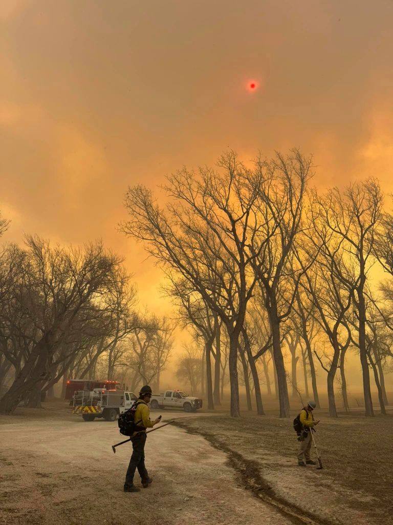
Wildland firefighters are working to contain multiple massive wildfires burning in the Texas Panhandle region and across the Plains, fueled by unseasonably hot weather and gusty winds.
Thankfully, the weather is set to improve Wednesday, with strong winds that had been impacting the fires expected to diminish to 15-25 mph, aiding in firefighting efforts.
Four major wildfires in the Texas Panhandle have consumed nearly 400,000 acres, prompting evacuations, road closures and emergency declarations.
On Thursday, parts of this region will see snow potentially falling on the fires as a weak low pressure moves into the Texas Panhandle from New Mexico, the FOX Forecast Center said.
Accumulations will be very light, generally under 1 inch.
However, as quickly as the weather shifts to help the firefight, it will shift back to potentially hamper it.
Temperatures on Friday will warm back into the 70s with 30-plus mph winds and relative humidity below 20%.
These conditions are expected to persist through the weekend.
On Tuesday, Texas Gov. Greg Abbott issued a disaster declaration for 60 Texas counties because of the rapidly spreading wildfires in the Lone Star State.
The declaration allows additional state resources to support local firefighters.
The largest fire burning in Texas is the Smokehouse Creek Fire north of Stinnett.


On Tuesday, the fire exploded in size, growing from 40,000 acres to 300,000 acres, making it the fifth-largest wildfire in Texas history.
Firefighters were working to protect people and structures as the fire rapidly spread toward the town of Canadian, Texas, in Hemphill County.
The wildfire burned through an automated weather structure known as a Mesonet station Tuesday afternoon.


According to the West Texas Mesonet, which operates the station, a temperature as high as 126 degrees was recorded at the site before it was destroyed.
Gusty winds between 40 and 50 mph pushed the fire north of Pampa, Texas, according to Texas A&M Forest Service.
Operations at a nuclear weapons facility outside of Amarillo were halted after flames got dangerously close to the property.

Late Tuesday, Pantex said all the facility’s employees were accounted for, and firefighters were in structure protection mode, but the property remains secure.
The video below shows the explosive North CIG Fire, which started Saturday south of Dumas, Texas, according to the Texas A&M Forest Service.
When the brush fire first started along CIG Road, it was about 750 acres.


By Sunday night, when the blaze was fully contained, the wildfire had consumed more than 4,000 acres.
A polar-orbiting satellite captured the stunning growth of the fire across the Texas Panhandle.
The dangerous situation was enhanced by an approaching cold front, which helped trigger windy conditions and erratic fire activity.
Gusty winds driving fire behavior
It’s not just Texas where dangerous fire weather conditions are prevalent.

This week, record heat and gusty winds have contributed to fire weather dangers across the Plains and central U.S.
High Wind Warnings and Watches and Wind Advisories cover much of the Plains and central U.S. through Wednesday.
These gusty winds are making ongoing firefights difficult in other fires burning in Colorado, Nebraska and across parts of the South.

A nearly 200-acre fire on the U.S. Air Force Academy grounds in Colorado continues to burn after sparking last weekend.
Multiple wildfires are burning in Nebraska, prompting emergency managers to issue evacuation orders. Wildfire smoke could be seen stretching for miles into the sky from the Custer-Lincoln County line, according to photos and video from Nebraska State Patrol troopers.
The smoke plume and heat signature were visible from NOAA’s GOES-16 satellite in space.
Some residents in North Platte, Nebraska, were told to evacuate after a grass fire north of the city began spreading east.
On Tuesday, Nebraska Gov. Jim Pillen approved states of emergency for Custer and Lincoln counties. Nebraska National Guard helicopters began water drops on the wildfire area.


