More snow expected to slam California mountains after nightmare blizzard
Thousands are still waiting for power to be restored and roads to be cleared across the Northern California mountains after a blizzard pounded the area over the weekend.
But there is no rest for the weary, as the next storm is already adding to the snowpack on snow-stunned mountains.
The National Weather Service issued Winter Storm Warnings to replace the Blizzard Warnings, as another 1 to 2 feet of snow are expected across the Sierra Nevada Mountains by Wednesday.
“Mountain travel will continue to be extremely dangerous to impossible and will remain difficult at best through Tuesday night,” NWS Sacramento forecasters wrote in a forecast discussion.
After a brief break from the snow, flakes fly again through Tuesday.
While not expected to create near-blizzard conditions, wind gusts to 45 mph will blow around the 8-10 feet of snow that fell over the weekend and the additional falling snow.

Even the Sacramento Valley could see gusts from 25-35 mph.
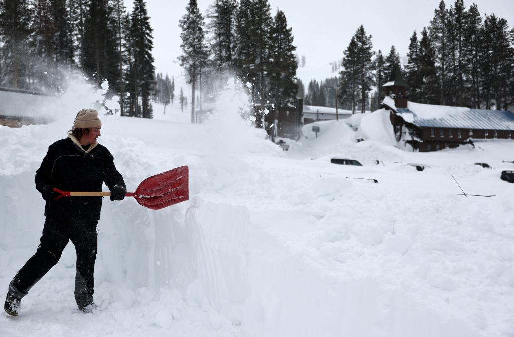
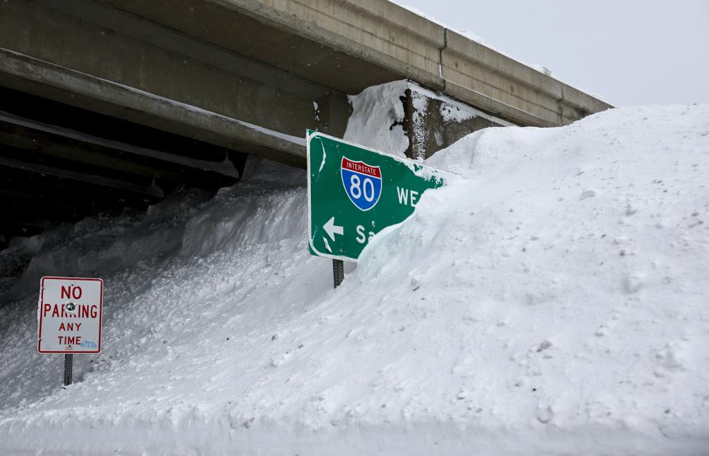
Parts of the Tahoe ski community are cut off because of the deep snow and one- to two-story-high snow drifts blocking the highways and interstates.
Crews are slowly letting passenger cars onto Interstate 80 after the snow shut it down. Another main highway was cleared, but crews occasionally held traffic to clear spinouts and for avalanche control.

Locals call the heavy, wet snow in the Sierra Nevada “Sierra cement.” And that cement took its toll on snowplows.
The snow took out two of the 10 snowblowers on plows at the Caltrans main hub and six of 20 in total from the California foothills to the Nevada state line.
The next system will be warmer, so while snow levels start off around 2,000 feet, they will rise up to 3,000-4,000 feet into Wednesday.

That still means a couple of inches for the foothills, with 1-4 feet in the higher elevations.
Even the highest elevations of the coastal ranges could see 1-2 feet of snow.
Rain is expected from the lower elevations over to the coast.

The extreme Northern California coast and Oregon will be in for the heaviest rainfall, with the possibility of another quick 3-plus inches of rain.
That is falling on saturated ground, so watch for landslides and ponding on roadways.
Next storm eyes Southern California
The next storm gearing up in the Pacific Ocean will head south, giving Northern California a much-needed break.
Widespread rain will move into Southern California in time for the Wednesday morning commute. Rain amounts aren’t too impressive – on the order of a half-inch to an inch – but it doesn’t take much rain to snarl a commute.
The Golden State dries out a bit and even warms up during the second half of the workweek before the next storm begins to develop off the West Coast during the upcoming weekend.