


Millions along I-95 corridor from New York to Boston face flood risk Wednesday
After a dousing of rain on Tuesday, those living along and east of the Interstate 95 corridor face the risk of flash flooding from another storm moving through Wednesday.
A weak coastal low moved up the East Coast, spreading rain northward into the mid-Atlantic and Northeast on Tuesday.
Soaking rain will again develop in the mid-Atlantic starting Wednesday morning and spread northward into the Northeast and New England later in the day.
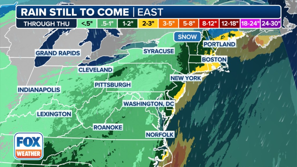
Rainfall totals between 1 and 3 inches are expected through Thursday.
Flash flooding will be a concern as atmospheric moisture is expected to be above average for this time of year.
“This next storm that’s moving in from the South is also going to bring in Gulf moisture,” FOX Weather Meteorologist Britta Merwin said. “So I think we have a larger potential of maybe having a flooding concern for the end of the week.”
A Flood Watch has been issued from New Jersey to Massachusetts through Thursday.

A Flood Warning continues for the Pawcatuck River at Westerly, Rhode Island, affecting Washington and New London counties.
“Interesting to see that hot spot in New England,” Merwin added. “That’s probably where we have the highest potential of flooding.”
Cold air will again be lacking but may overlap just enough to bring light snow amounts to northern New England.

The next chance for any snow will come this weekend as an area of low pressure moves in from the Midwest, according to the FOX Forecast Center.
The forecast remains highly uncertain as computer forecast models are still trying to figure out where the low will track and whether enough cold air will be in place.


