Parts of New York could be hit with six inches of snow as third storm this week eyes Northeast
The Northeast can expect to face yet another storm this week, with heavy rain, strong winds and snow forecast to hit the region starting Saturday afternoon.
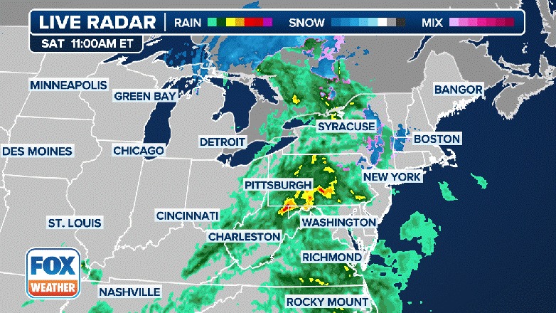
The system is moving in from the Ohio Valley on Saturday with rain picking up from west to east, reaching eastern New England by Saturday night.
“I had plans this afternoon for outdoors, and they might be rearranged,” FOX Weather Meteorologist Kendall Smith said Saturday morning. “I knew that was going to have to happen probably, and I think that’s pretty much the same for a lot of people today.”
Unlike the first two storms, there will be cold air in place across northern New England.
Snow should break out at the onset of the event and continue through the day on Sunday, the FOX Forecast Center said.
As much as 6-plus inches of snow is becoming increasingly likely across the higher elevations of northern New York, Vermont, New Hampshire and northern Maine.
Communities south and east of the Great Lakes have been placed under Winter Storm Watches and Warnings due to the threat of heavy snowfall and gusty winds.
Accumulations in the warning areas could reach 6-16 inches of heavy, wet snow, depending on location and elevation.
Northern Maine could see their largest snowfall of the season, according to the FOX Forecast Center.
“The higher elevations, note places like the Appalachian Mountains and also into northern New England, that’s where we are going to see the majority of that rain transition over to some snow,” Smith said. “New York, D.C., though, all just rain, and it’s also going to be pretty windy at times.”
To the south, the FOX Forecast Center said there will be yet another dose of rain in a week that has had lots of it.


By the time it’s over, some places in the Northeast may see over 8 inches of rain between the three events.
At the coast, south-southeasterly strong winds will whip up waves along the New England coast and could lead to significant coastal flooding with high tide Saturday night and Sunday morning.
Sunday is a New Moon, so astronomical tides will already be high.
The FOX Forecast Center said it won’t take too much of an onshore push of winds to cause issues.

Coastal flood alerts are in effect from Down East Maine to the Delmarva, covering most of the Northeast coastline.
As the storm moves away from Sunday night into Monday, strong northerly winds will drag cold air south from Canada in its wake.
Winds could gust over 40 mph, leading to downed trees and scattered power outages.

The rain-snow line will then drop south, with cities such as Hartford, Providence and Boston potentially seeing the flakes fly before the storm ends.
However, the storm will not stop there, widespread lake-effect and lake-enhanced snow will break out Monday, the FOX Forecast Center said.
Cold air will continue spilling in behind the low, leading to additional snow.