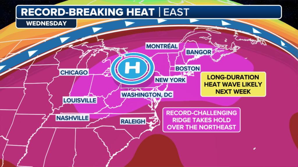
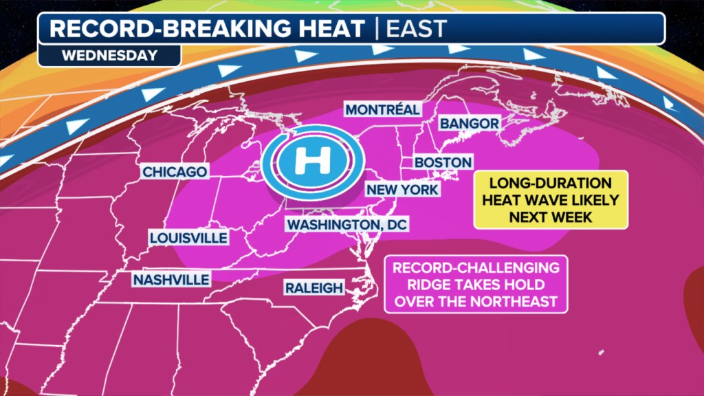
A significant ridge of high pressure that is expected to establish itself over the Northeast and Ohio Valley will cause temperatures during the workweek to skyrocket to levels not experienced in several years.
The heat wave is expected to send temperatures upwards of 20 degrees above what is typical in mid-June, with heat indices in the dangerous range.
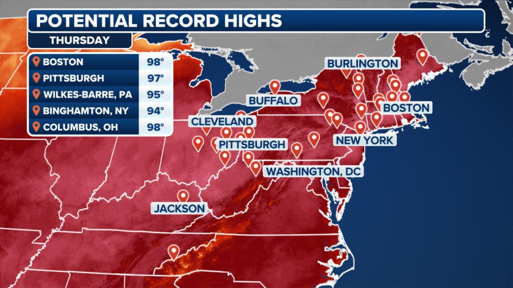
New York City is expected to reach the mid-90s on Thursday, while Boston could reach the upper 90s.
Some communities could even reach 100 degrees, as the full effects of summer are felt throughout the region.
Hundreds of daily records from the Mississippi Valley to New England are set to fall, with even some all-time records also in jeopardy of being eclipsed.
If temperatures come in warmer than expected, some major cities along the Interstate 95 corridor could even approach 100 degrees.
The Big Apple has not seen a 100-degree reading since July 18, 2012, during one of the worst heat waves in modern history.

“Not only is it going to be hot, it’s going to be stagnant conditions. You’re not going to have any kind of breeze that will cool you off either by the time we get into the middle to latter half of the week,” said FOX Weather meteorologist Steve Bender.
Overnight temperatures are not expected to provide much relief from the heat, with lows only dropping into the 70s after sunset.
Warm nighttime temperatures can induce additional heat stress on the body and lead to increased demand for air conditioning, resulting in higher utility costs as buildings struggle to cool down.
Heat to reach life-threatening levels
In many of the areas where daily records could be broken or there is a lot of pavement, the National Weather Service’s HeatRisk map has labeled communities at a Level 3 or 4 out of 4 for impacts.
The HeatRisk threat level takes into consideration the unusual nature of the heat, the duration of the extreme temperatures and potential health impacts.
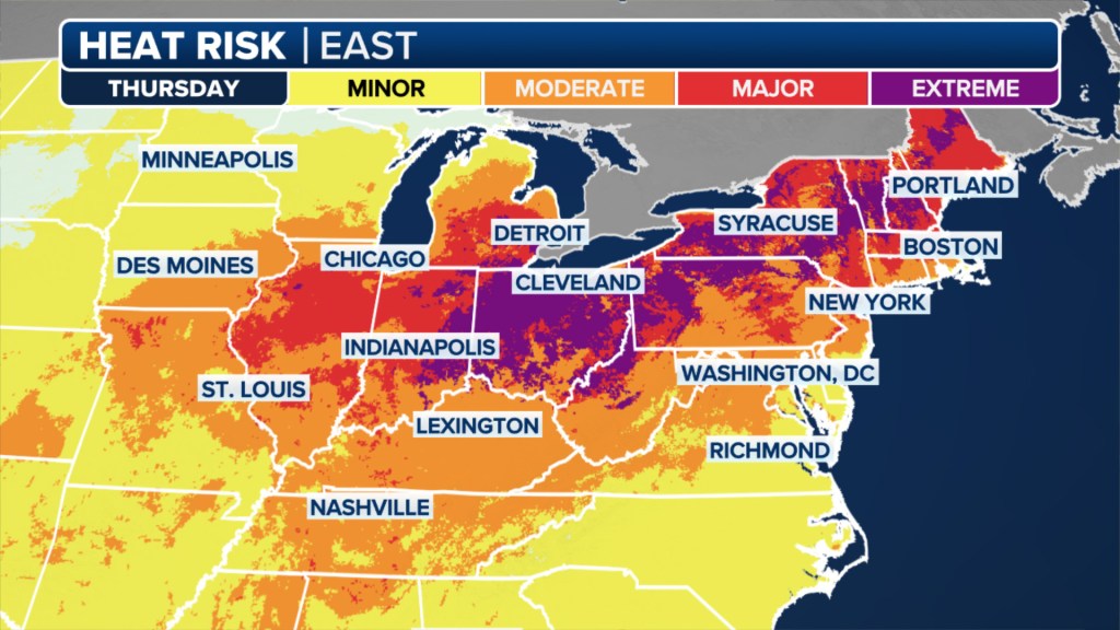
At a code red (Level 3) stage, heat affects anyone who is not adequately hydrated or those without access to cooling.
Magenta (Level 4 signifies) extreme heat that is either rare or long in duration. Health systems can be impacted by an influx of patients with heat-related illnesses.
During the height of the heat wave on Thursday, most residents in Ohio, Indiana, New York and Vermont will find themselves at a Level 4 out of 4.
The Centers for Disease Control and Prevention reports that the most common illnesses from warm temperatures are heat exhaustion and heat stroke.
Health experts warn that heatstroke occurs when the body’s internal temperature rises rapidly, overwhelming its ability to cool down.
Heatstroke can result in serious health complications and is most prevalent among young children and older adults.
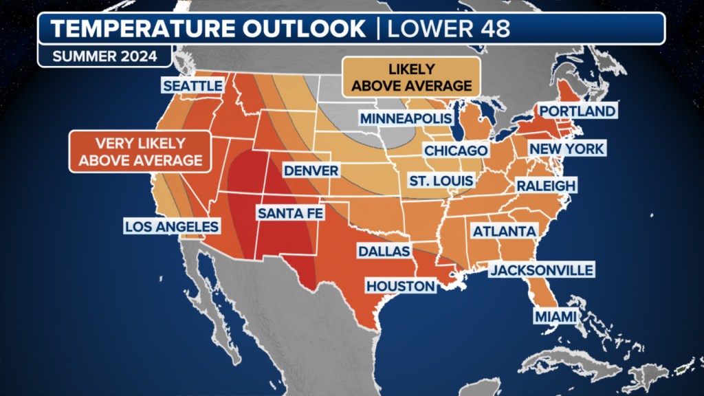
Extreme heat was expected by long-range outlooks
NOAA’s Climate Prediction Center started calling for the I-95 corridor to be the subject of summer heat waves during outlooks released over the past winter.
The extreme heat appears to have staying power with only limited interruptions during the first half of summer.
The outlook is much different than in 2023, when the region saw only its 35th warmest summer on record.