Ocean Acidification Data
Projects funded by NOAA’s Ocean Acidification Program collect a variety of data to understand changing ocean chemistry and its impacts on ecosystems and communities.
We provide access to ocean acidification data for researchers, policy-makers, and anyone interested in learning more about our changing ocean.
OAP, in coordination with the IWG-OA, commits to providing easily-accessible data relating to ocean and coastal acidification. We collect and showcase data from federally funded research, from Federal, State, or local governments, academic scientists, community scientists, industry organizations, Tribes, and from existing global or national data assets currently maintained by federal agencies.
Access quality ocean acidification data
Learn more about ocean acidification by exploring trends and real-time data
Ocean Acidificaton Indicators

NOAA National Marine Ecosystem Status (NaMES)
The NaMES website captures the status and trends of ocean acidification in eight U.S. ecosystem regions and the nation overall. This tool provides the opportunity to explore the key indicators for our changing ocean.
NaMES provides ocean acidification indicators for pCO2, pH, and mineral aragonite (Ωar). These indicators help us understand the health status of an ecosystem.
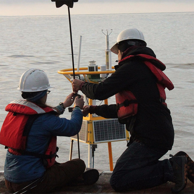
Buoys and Moorings
OAP-Supported Buoys and Mooring Data
OAP supports 15 buoys in coastal, open-ocean, and coral reef waters that contribute to NOAA’s Ocean Acidification Observing Network. This monitoring program is maintained by and housed in NOAA’s Pacific Marine Environmental Laboratory’s (PMEL) Carbon Program. Data collected from buoys record CO2 in the surface ocean and in air every 3 hours to capture both seasonal and year-to-year variability. These measurements help us identify trends that occur from human-caused ocean acidification and allow us to predict and respond to changes in our ocean and climate.
The Great Lakes also has a new monitoring network in partnership with NOAA’s Great Lakes Environmental Research Laboratory (GLERL) with the first ocean acidification buoy located in Lake Huron. Data collected in the Great Lakes allow us to understand acidification from the absorption of atmospheric CO2 in important freshwater systems. Learn more about freshwater acidification.
The map below displays the location of OAP-sponsored buoys.
Click on the marker icon to access information on the specific buoy.
OAP-Supported Buoys & Moorings
Coral Reef Moorings
Cheeca Rocks
CRIMP-2
Fagatele Bay
Kanoehe
La Parguera
Great Lakes Moorings
Alpena – Thunder Bay
IOOS Regional Data Portals
Regional associations sponsored by the Integrated Ocean Observing System (IOOS) host data portals for OAP-supported moorings. Search for variables such as pH and pCO2 in near real time and in the past using these portals.

Data Tools
OCADS Data Portal
NOAA OAP funds the Ocean Carbon and Acidification System (OCADS) Project, building a collaborative approach with shared responsibilities among scientists, data managers, and data partners.
OCADS ensures data collected from OAP-funded research and other sources is archived and accessible for ocean carbon and ocean acidification analyses, forecasting capabilities, and better assessments of marine resource vulnerability. OCADS is envisioned as the best data management service to support regional to global ocean carbon cycling and ocean acidification research. It builds upon a U.S. National ocean acidification data management and integration service required by the Federal Ocean Acidification Research and Monitoring Act, enacted in 2009.

Global Ocean Acidification Observing Network (GOA-ON) Portal
NOAA OAP partners with international organizations to support the Global Ocean Acidification Observing Network (GOA-ON). GOA-ON works to improve our understanding of global ocean acidification conditions and ecosystem responses by making ocean acidification data easily discoverable.
The GOA-ON Data Explorer provides discovery and visualization to ocean acidification data and data synthesis products being collected around the world from a wide range of sources, including moorings, research cruises, and fixed time series stations.

Coastal Ocean Data Analysis Product in North America (CODAP-NA, Version 2021)
This OAP-funded data product provides an internally consistent data product for discrete inorganic carbon, oxygen, and nutrients on the U.S. North American ocean margins, i.e., Coastal Ocean Data Analysis Product (CODAP-NA). It is created by compiling, quality controlling (QC), and synthesizing two decades of discrete measurements of inorganic carbon, oxygen, and nutrient chemistry data from North America’s U.S. coastal oceans.

Forecasting Models

J-SCOPE Seasonal Coastal Ocean Predictions
The JISAO Seasonal Coastal Ocean Prediction of the Ecosystem (J-SCOPE) forecasts support the California Current Integrated Ecosystem Assessment Integrated Ecosystem Assessments (IEAs), which are a framework for informing ecosystem-based management. J-SCOPE provides short term (six to nine month) testable forecasts of ocean conditions relevant to management decisions for fisheries, protected species and ecosystem health. Results will directly inform the IEA process, and will forecast indicators requested by the Pacific Fishery Management Council. NANOOS is the regional IOOS data portal that hosts J-SCOPE and associated data.

Chesapeake Bay Atlas for Physical and Biogeochemical Conditions
This archive provides an atlas of physical and biogeochemical conditions for the Chesapeake Bay based on numerical model results of 1985-2023. The atlas includes surface and bottom conditions on a fine longitude/latitude grid with a monthly frequency. The environmental variables are stored in a NetCDF file with abundant metadata that can be used in software such as QGIS, Python, R, Matlab or GNU Octave. A 50+ page documentation in PDF format provides additional information on the environmental variables, the numerical model used to generate the climatology, and an evaluation of the model skill over the period of the atlas. The documentation also includes ready-made visualizations for each environmental variable.

Chesapeake Bay Environmental Forecast System (CBEFS)
The Chesapeake Bay Environmental Forecast System (CBEFS) provides forecasts and “nowcasts” for several environmental variables in the Chesapeake Bay. OAP funded outputs include surface and bottom pH, surface and bottom alkalinity, and bottom and surface aragonite saturation state.
Get involved with ocean acidification
The NOAA Ocean Acidification Program exists to meet the ocean acidification research and monitoring needs of the U.S. See how you can get involved to serve your community and participate in cutting-edge research and education and outreach.