NORFOLK, Va. — We have more heat and humidity in our forecast for Hampton Roads.
Chances for showers and storms will continue this week as well. It was a rain-free start to our Monday, but after midday isolated showers and storms will be possible. While we are not outlooked for severe storms, thunderstorms that develop will produce dangerous lightning. Some of the downpours could be locally heavy as well.
![](https://media.13newsnow.com/assets/WVEC/images/cf8ec374-7698-4b6b-b612-c61b69bea8ab/20240708T101540/cf8ec374-7698-4b6b-b612-c61b69bea8ab_16x9.jpg)
![](https://media.13newsnow.com/assets/WVEC/images/cf8ec374-7698-4b6b-b612-c61b69bea8ab/20240708T101540/cf8ec374-7698-4b6b-b612-c61b69bea8ab_1140x641.jpg)
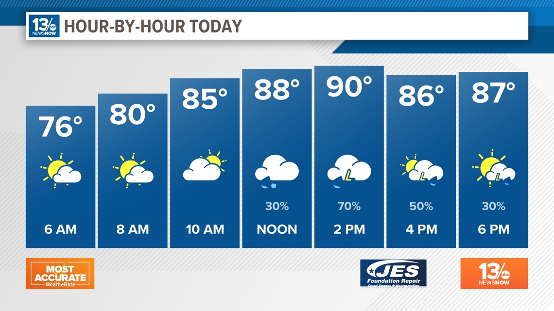
Highs today will be near normal for this time of year. Once you factor in the high humidity, it will feel like the upper 90s to near 100°.
![](https://media.13newsnow.com/assets/WVEC/images/de7b79f3-e596-4b08-af54-6043f0328d4a/20240708T111107/de7b79f3-e596-4b08-af54-6043f0328d4a_16x9.jpg)
![](https://media.13newsnow.com/assets/WVEC/images/de7b79f3-e596-4b08-af54-6043f0328d4a/20240708T111107/de7b79f3-e596-4b08-af54-6043f0328d4a_1140x641.jpg)
And the heat goes on... highs will be in the lower 90s over the next week. Showers and storms are possible every day through Saturday.
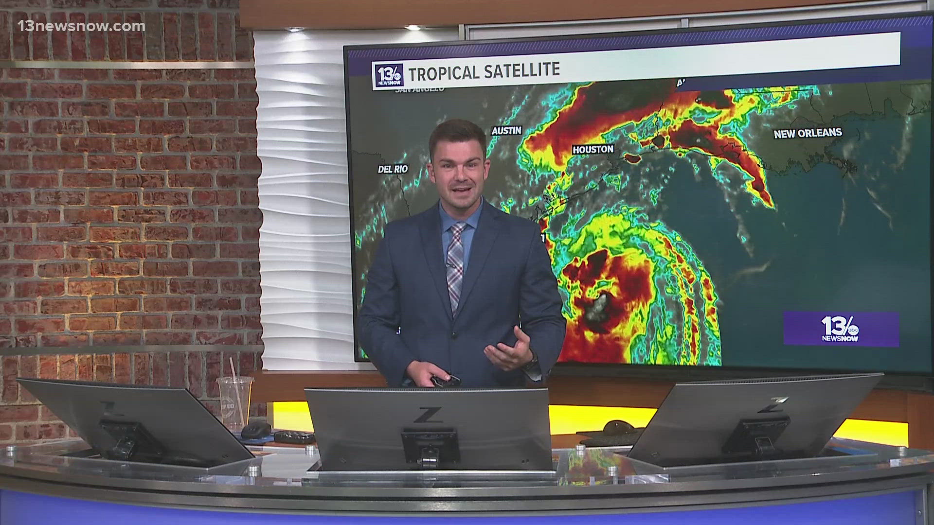
![](https://media.13newsnow.com/assets/WVEC/images/b875e967-1a66-4077-bbff-6add75bc5dab/20240708T102920/b875e967-1a66-4077-bbff-6add75bc5dab_16x9.jpg)
![](https://media.13newsnow.com/assets/WVEC/images/b875e967-1a66-4077-bbff-6add75bc5dab/20240708T102920/b875e967-1a66-4077-bbff-6add75bc5dab_1140x641.jpg)
In the Tropics...
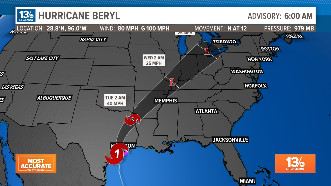
Beryl continues to churn in the Gulf of Mexico, eyeing down another landfall, but this time in Texas.
Hurricane Beryl made landfall this morning around 4:50AM EDT at Matagorda Texas with winds of 80 mph. The system is now over land and will weaken, but there is still a risk of damaging hurricane-force wind gusts and flooding rain over portions of the eastern Texas Monday. The storm system will move north across eastern Texas and then turn northeast and move across Arkansas Tuesday. After that, the weakened system will be a rainmaker over the Ohio River Valley.
![](https://media.13newsnow.com/assets/WVEC/images/db54fa79-35ff-41c8-9d45-3359492bef25/20240708T102221/db54fa79-35ff-41c8-9d45-3359492bef25_16x9.jpg)
![](https://media.13newsnow.com/assets/WVEC/images/db54fa79-35ff-41c8-9d45-3359492bef25/20240708T102221/db54fa79-35ff-41c8-9d45-3359492bef25_1140x641.jpg)
![](https://media.13newsnow.com/assets/WVEC/images/a4d46f23-9718-4a8c-9c1e-e6d9e22ae4a2/20240708T101638/a4d46f23-9718-4a8c-9c1e-e6d9e22ae4a2_16x9.jpg)
![](https://media.13newsnow.com/assets/WVEC/images/a4d46f23-9718-4a8c-9c1e-e6d9e22ae4a2/20240708T101638/a4d46f23-9718-4a8c-9c1e-e6d9e22ae4a2_1140x641.jpg)
Stay connected 24/7 via 13News Now