
HOUSTON —
THIS PAGE WILL NO LONGER BE UPDATED. CLICK HERE FOR UPDATES ON HURRICANE BERYL.
_________________
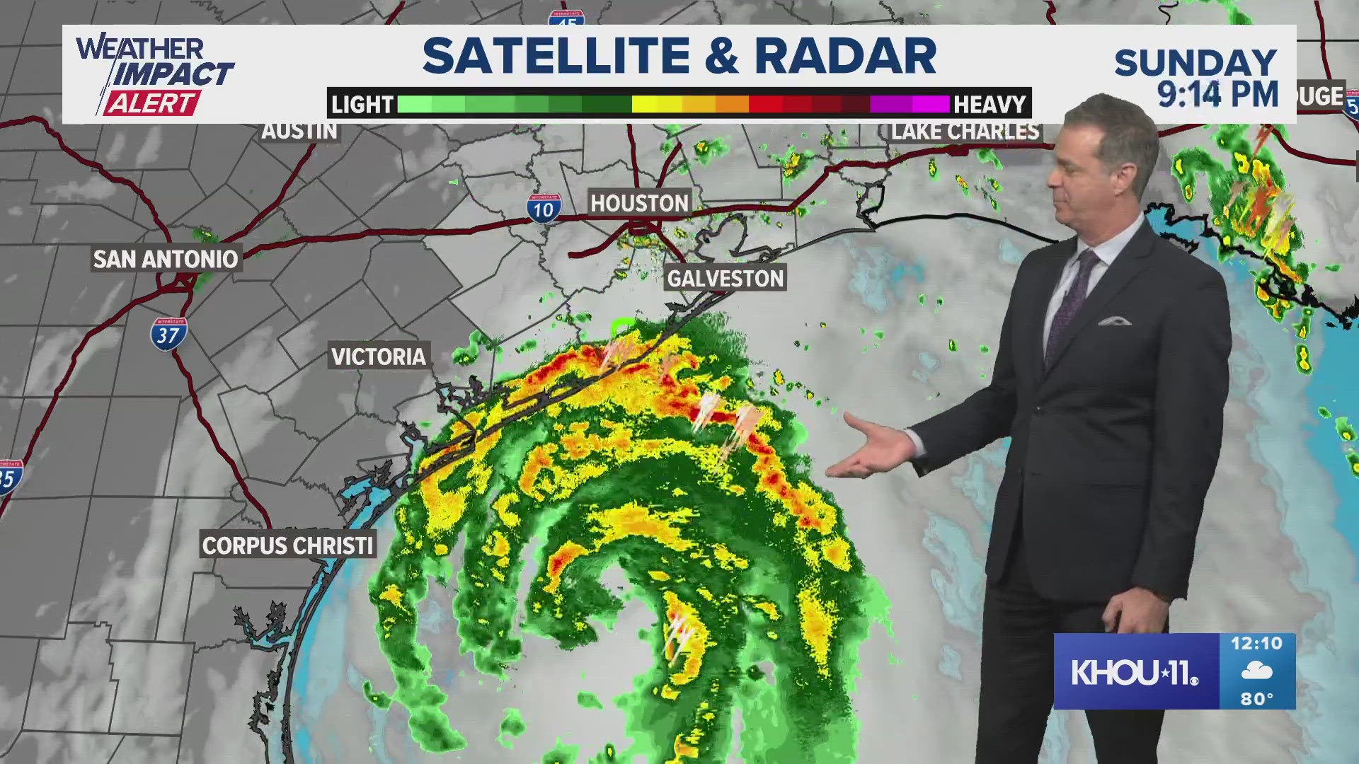
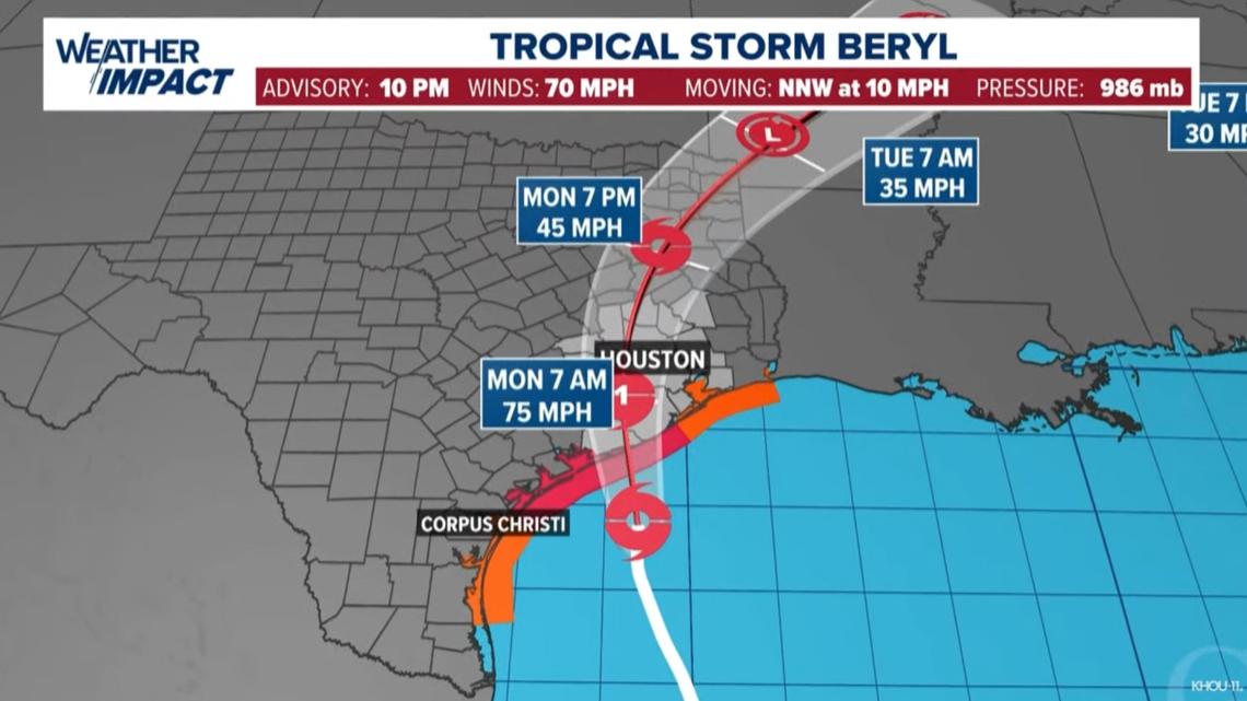
As of the 10 p.m. Sunday update, Beryl is on the heels of regaining hurricane strength with sustained winds up to 70 mph. Pressure continues to fall, indicating further strengthening through the overnight. Movement is north-northwest at around 10 mph. The National Hurricane Center is still forecasting Category 1 hurricane strength at landfall somewhere near or just east of Matagorda Bay.
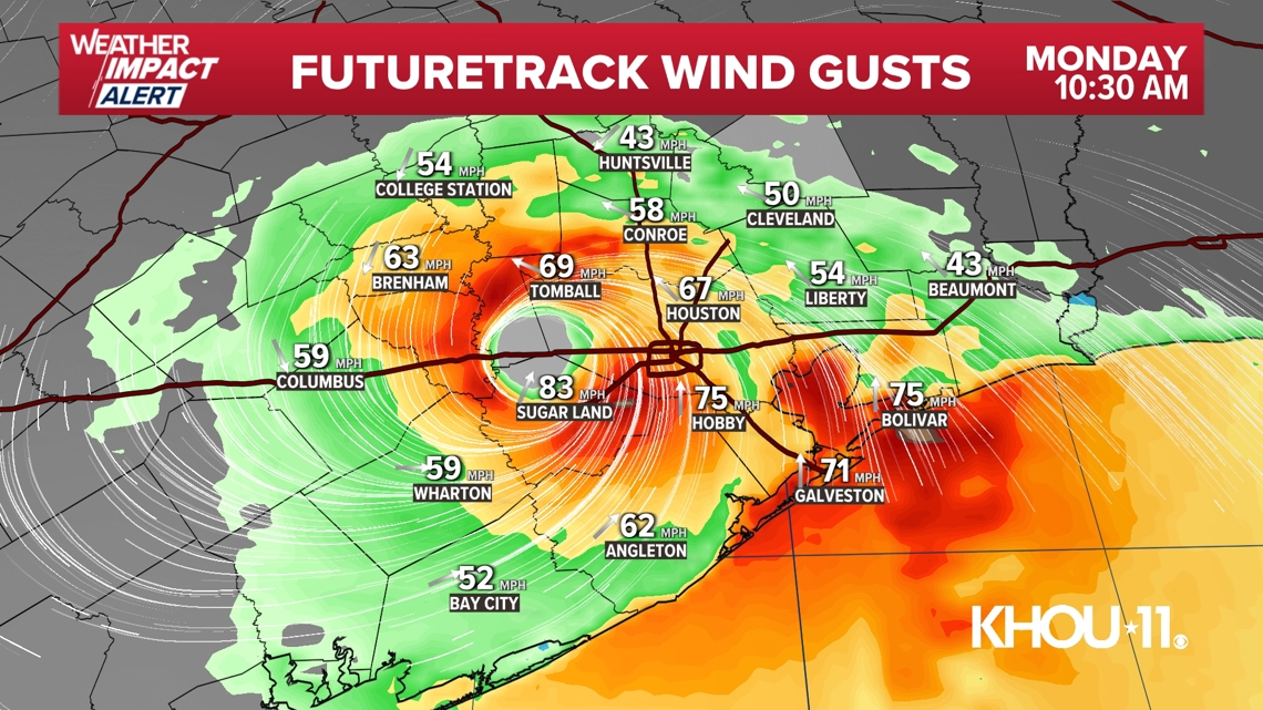
The worst of the storm is expected between 2 a.m. and 2 p.m. for much of Southeast Texas. Conditions will rapidly decline at the coast just after midnight. The City of Houston should see the worst impacts from rain and wind between 3 a.m. and 10 a.m. Areas north of Houston should expect the worst from 5 a.m. to 2 p.m.
The KHOU 11 Weather Team issued a Weather Impact Alert Day for Sunday as Beryl approached. Monday is also a Weather Impact Alert Day. The biggest impact will be between 1 a.m. and 1 p.m. on Monday. Tuesday was originally supposed to be a Weather Impact Alert Day, but it's been removed as models show Beryl racing out of the Houston area and will be in North Texas by Tuesday morning. Click here for Spanish coverage of Tropical Storm Beryl.
SPECIAL TROPICAL STORM BERYL COVERAGE: KHOU 11 will have coverage of Tropical Storm Beryl on air and online Sunday, We'll be on KHOU.com, the KHOU 11 app and KHOU 11+ hourly with the latest updates on the storm. Download the KHOU 11 app and we'll alert you when we're going on.
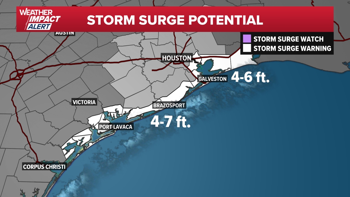
Storm surge forecasts have increased for the entire Upper Texas Coast, including Galveston. Water rises of up to 7 feet will be possible along coastal areas near landfall. Galveston could see storm surge of up to 6 feet overnight, including Galveston Bay. As a result, storm surge warnings are up for the entire coast, including all of Galveston Bay.

Hurricane, tropical storm warnings

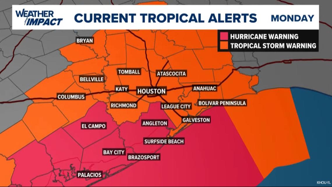
A Hurricane Warning is in effect from San Luis Pass to Port Bolivar.
Tropical Storm Warnings remain in effect for all of Southeast Texas through Monday.
A Tornado Watch is in effect until 10 a.m. for Harris, Montgomery, Galveston, Fort Bend, Brazoria, Chambers, Liberty and Matagorda counties.

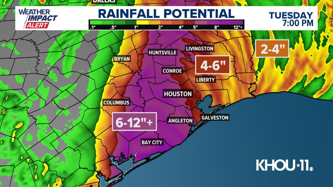
Although Beryl will weaken once over land, the storm will start to move quicker on Monday. As a result, substantial weakening is not expected until the storm passes through Houston on Monday afternoon. Tropical storm force winds of up to 70 mph are possible in the City of Houston by midday Monday. Higher gusts, near 90 mph, are possible along the coast during landfall.

The good news is that conditions will rapidly improve Monday evening as Beryl races away from the area. Conditions will quickly dry out during the evening, and the sun will even break through the clouds for a large portion of the area. Tuesday looks much calmer, albeit hot, with sunshine returning and highs in the mid-90s.
Beryl 10 P.M. statistics
With the 10 p.m. Sunday update, Beryl was a tropical storm with maximum sustained winds of 70 mph, moving north-northwest at 10 mph. National Hurricane Center advisory in Spanish.
Live tropical tracker
Beryl forecast cone

Be prepared
Disaster declaration


There are now more than 120 Texas counties under a disaster declaration, including Harris, Ft. Bend, Galveston, Brazoria, Montgomery and more. You can see the full list of counties here.
Evacuations
Officials called for voluntary evacuations in parts of Galveston, Matagorda and Brazoria counties.
Sunday afternoon, the Town of Quintana ordered a mandatory evacuation order.
Matagorda County evacuations are for those living on or visiting areas along the coast, including residents in Sargent, Matagorda and Palacios.
The Galveston County order went into effect at 10 a.m. Sunday for residents and visitors west of 103rd Street not protected by Galveston’s Seawall.
Brazoria County called for voluntary evacuation for all low-lying areas south of the Intracoastal Canal, including Bryan Beach, the Village of Quintana, the Village of Surfside Beach, Follett's Island, and Treasure Island.
Record-setting Beryl
The 2024 Atlantic Hurricane Season was promised to be an active one, with Colorado State University and NOAA predicting well above normal numbers. In fact, the NOAA forecast for the season was the most aggressive forecast ever produced. Several factors including record warm sea-surface temperatures and a transition to La Nina by late summer were the driving factors in these aggressive forecasts. However, Hurricane Beryl is already shattering records before the peak of the season arrives. Meteorologist Pat Cavlin has a list of records the storm has already broken.