Track Wildfires in the U.S.
Daily Summary
Updated
Notable Fires
Thompson
- 3,800 acres
- No change in past day
- 28,000 people live within five miles
Clear
- Size unknown
- No change in past day
- 44,000 people live within five miles
0353 RV McCaffery
- 250 acres
- +250 acres/past day
- 16,000 people live within five miles

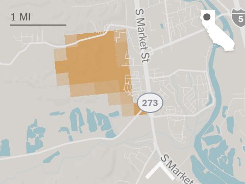
Sheep Company
- 330 acres
- +30 acres/past day
- 6,100 people live within five miles
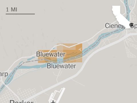
Blue Water
- 5 acres
- +5 acres/past day
- 3,800 people live within five miles
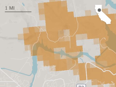
Lake
- 12,000 acres
- +5,100 acres/past day
- 500 people live within five miles

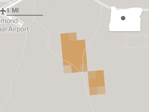
Upper Applegate
- 1,100 acres
- No change in past day
- 1,200 people live within five miles
Silver King
- 3,000 acres
- +2,500 acres/past day
- 400 people live within five miles
Related


Methodology
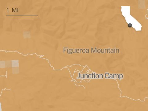
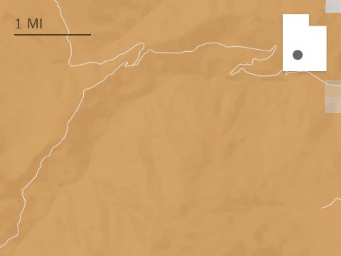
The map includes active and recent fires reported by the Wildland Fire Interagency Geospatial Services Group. The locations of the fires on the map are approximate, derived from data reported by the NASA FIRMS satellite-based fire detection system, which makes observations several times a day. Areas marked in red indicate where active burning was detected within 24 hours of the most recent fires reflected on the map. The exact boundary of a fire may differ from the extent shown on the map by 500 meters or more.
Air quality data is derived from PurpleAir sensors. Colored squares show levels of particulate matter in the air that average 2.5 microns or smaller in diameter where sensor data is available within a 10-mile radius of each square’s position. Readings have been adjusted to account for the properties of wood smoke. The quality levels are based on the Air Quality Index developed by the U.S. Environmental Protection Agency.
Population counts are rounded estimates. Totals are calculated using 2020 nighttime estimates from the Landscan, a population database generated by Oak Ridge National Laboratory.
Credits
By Matthew Bloch, Josh Williams, Rumsey Taylor, Tim Wallace, John-Michael Murphy and Tiff Fehr. Additional production by Jon Huang.
Expand Dashboard