16 Lighthouse Hikes You Can Enjoy All Year
Washington has endless miles of beautiful coastline that makes for wonderful hiking all year — cool in the summer and snow-free in the winter. One charming aspect of our shorelines are lighthouses that have guided the way for mariners for years.
Many of those lighthouse are still operational. Some are closed to the public, but some can still be visited, and even offer tours. Here are 16 hikes featuring lighthouses, from the Pacific Coast to the Salish Sea.
Greater Puget Sound
Admiralty Head Lighthouse
Location: Whidbey Island, near Coupeville
Length: 2.5 miles, roundtrip
Elevation Gain: 200 feet
Grounds/facilities: Grounds open. Building open seasonally.
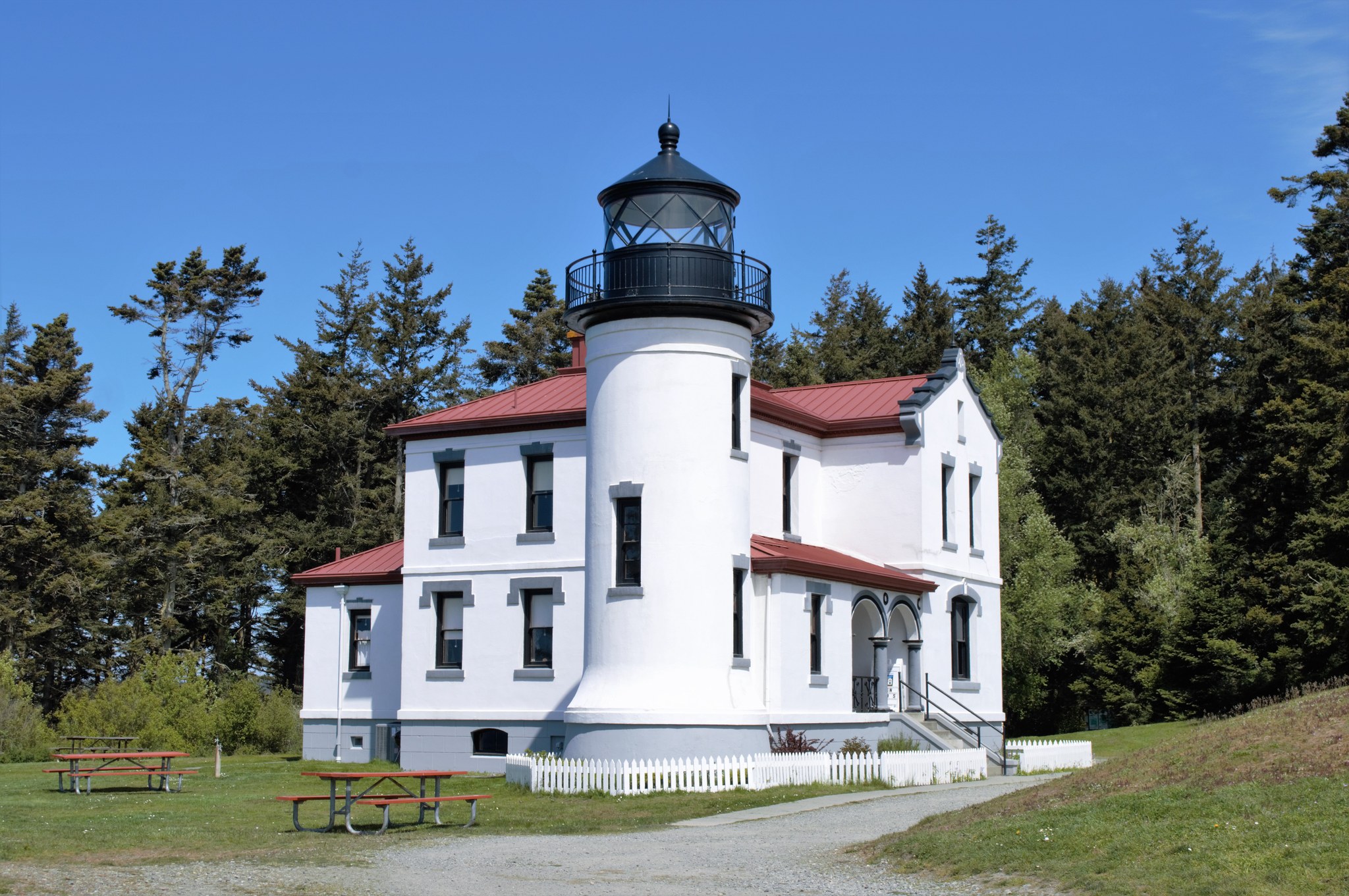
Admiralty Head Lighthouse. Photo by Hiking Hobbit.
This casual hike in Fort Casey State Park begins at Admiralty Head Lighthouse and is along the beach for about a mile. Once you leave the beach, look for interpretive signs along the trail and at the lighthouse to tell you about the local Native American tribes, the lighthouse lens and more. During most of the year, you can even tour the lighthouse.
> Plan your trip to Admiralty Head Lighthouse using WTA's Hiking Guide
Alki Point Lighthouse
Location: West Seattle
Length: up to 8 miles of trail
Elevation Gain: minimal
Grounds/facilities: Building open to tours on Sunday afternoons in the summer.
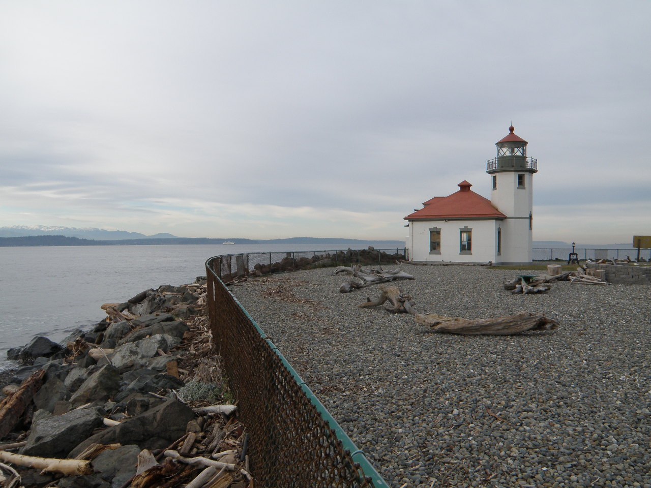
Alki Point Lighthouse. Photo by C P
Stroll along the water with stunning views across to Seattle, and on the other side of Alki Point, Mount Rainier. You can make this walk as long or short as you like, depending upon where you start. but note that the lighthouse, while open for tours, is not accessible via the beach.
To reach the it, you'll want to hop on Beach Drive as you approach Alki Point, and walk along the sidewalk to the entrance gate. (Please note that the area surrounding the lighthouse on the beach is private property.)
> Plan your trip to Alki Point Lighthouse using WTA's Hiking Guide
Marrowstone Point Lighthouse
Location: Marrowstone Island — near Hood Canal
Length: 5 miles, roundtrip
Elevation gain: 150 feet
Grounds/facilities: Grounds and tower are closed, but can be viewed from beach and overlooks.

Marrowstone Point Lighthouse. Photo by TIMBER.
Enjoy a big loop around Fort Flagler Historical State Park, including views of the lighthouse as well as many other historic buildings. This loop includes a nice variety of time on the beach and time in the forest.
> Plan your trip to Marrowstone Point Lighthouse using WTA's Hiking Guide
New Dungeness Lighthouse
Location: Near Sequim, North Olympic Coast
Length: 11 miles, roundtrip
Elevation Gain: 130 feet
Grounds/facilities: Grounds open. Museum and lighthouse open for tours from 9 a.m. to 5 p.m. daily. Volunteer keepers stay at the dwelling.

New Dungeness Lighthouse. Photo by trip reporter ChunkyMonkey.
This stunning lighthouse is at the end of a very long beach walk. You're likely to see wildlife, including birds and seals on your way. Once you arrive, you can take a look around inside the lighthouse and learn about its history. Volunteer keepers can show you around and answer your questions.
> Plan your trip to New Dungeness Lighthouse using WTA's Hiking Guide
Point Robinson Lighthouse
Location: Maury Island (via Vashon Island ferry)
Length: 0.5 mile, roundtrip
Elevation Gain: 100 feet
Grounds/facilities: Grounds open. Tours on Sundays from May to September. Two guest houses are available for rent year round.

Point Robinson Lighthouse. Photo by AKorn.
Enjoy a short stroll and pretty views of the lighthouse and beyond to Mount Rainier. This light is just across the water from the lighthouse on Alki Point. And, unless you live on Vashon, you get the bonus of a ferry ride for this trip.
> Plan your trip to Point Robinson Lighthouse using WTA's Hiking Guide
Point No Point Lighthouse
Location: Kitsap Peninsula
Length: 2 miles, roundtrip
Elevation Gain: 100 feet
Grounds/facilities: Grounds open. Lighthouse open noon to 4 p.m. on weekends, April through September. Half of lighthouse keeper’s quarters available as a rental.

Point No Point Lighthouse. Photo by JoeHendricks.
This hike offers plenty of chances for reflecting on history. This was where the Point No Point Treaty was signed in 1855. Tribes ceded land to the United States and were forced into reservations. The beginning of the trail passes by a stone monument that acknowledges the signing of the treaty. The trail then continues to views of wetlands and the coastline.
> Plan your trip to Point No Point Lighthouse using WTA's Hiking Guide
Point Wilson Lighthouse
Location: Port Townsend
Length: 2.5 miles
Elevation Gain: minimal
Grounds/facilities: Building and immediate grounds closed, but picnic tables nearby.
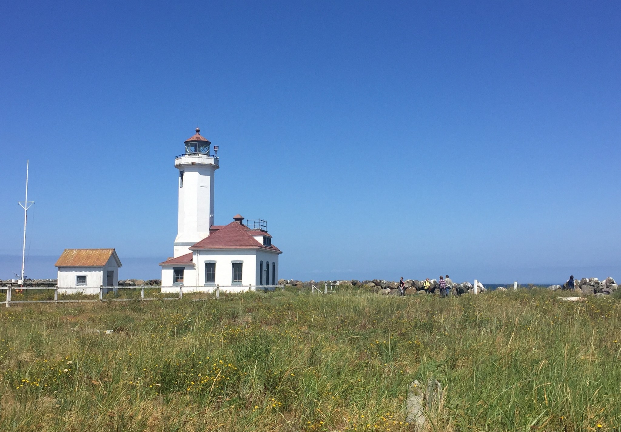
Point Wilson Lighthouse. Photo by LZhang.
Enjoy a long walk on the beach as you watch the waves and plenty of birds. The beach extends to the lighthouse, for a close-up view of the light. Or try exploring some of the nearby trail in the state park for lovely views from higher up.
Please note that lighthouse grounds are not open to visitors, but the lighthouse is also open for tours and for visitors to climb the lighthouse from 11 a.m. to 4 p.m. on Saturdays and Sundays from May through September.
> Plan your trip to Point Wilson Lighthouse using WTA's Hiking Guide
West Point Lighthouse
Location: Discovery Park, Seattle
Length: 2.8 miles, roundtrip
Elevation Gain: 140 feet
Grounds/facilities: Building and immediately surrounding grounds closed. But you can get a close view, just stay beyond the fence.
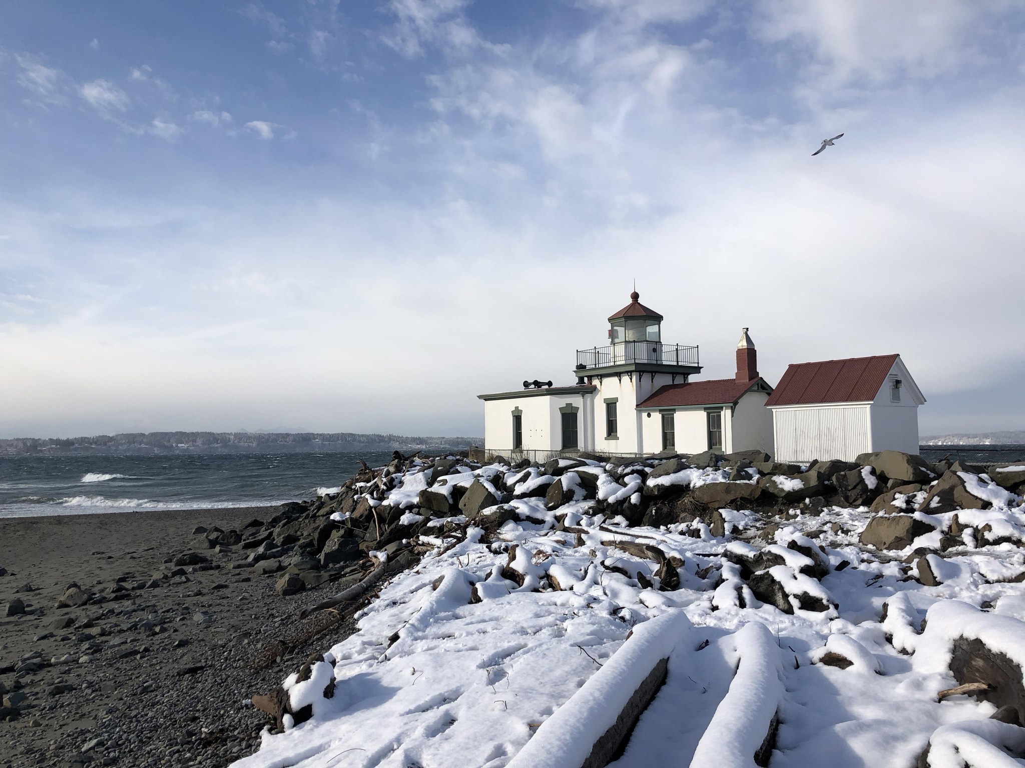
West Point Lighthouse. Photo by jeffdill.
Discovery Park is a popular spot for all sort of folks to enjoy a close-in adventure. And, if you follow the trails down to the water, you can enjoy the views of the iconic West Point Lighthouse.
> Plan your trip to West Point Lighthouse using WTA's Hiking Guide
San Juan Islands
Cattle Point Lighthouse
Location: San Juan Island
Length: 0.5 mile, roundtrip
Elevation Gain: 25 feet
Open: Grounds are open, but building is closed.

Cattle Point Lighthouse. Photo by trip reporter Impromptu Disco.
A visit to Cattle Point Lighthouse is a short, easy trip and great for families. You can admire the lighthouse, which was built in 1935 before wandering down to the water’s edge to admire the view.
> Plan your trip to Cattle Point Lighthouse using WTA's Hiking Guide
Lime Kiln Lighthouse
Location: San Juan Island
Length: 1.35 miles, roundtrip
Elevation gain: 276 feet
Open: Tours in summer months on Thursdays and Saturdays.
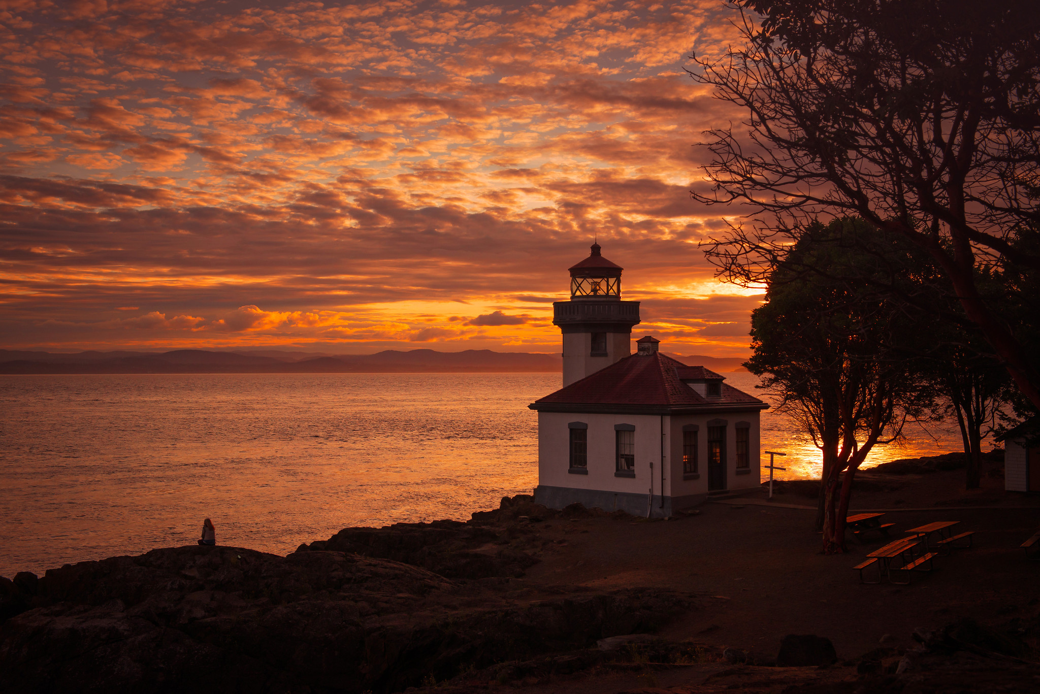
Lime Kiln Lighthouse. Photo by Joanie Christian.
This short trip offers a profusion of riches for hikers. You can see a historic lime kiln, watch for whales and other wildlife, and — of course — admire the extremely scenic Lime Kiln Lighthouse.
> Plan your trip to Lime Kiln Lighthouse using WTA's Hiking Guide
Patos Island Lighthouse
Location: Patos Island in the San Juans
Length: 1.5 miles, roundtrip
Elevation Gain: 30 feet
Grounds/facilities: Grounds and lighthouse open.
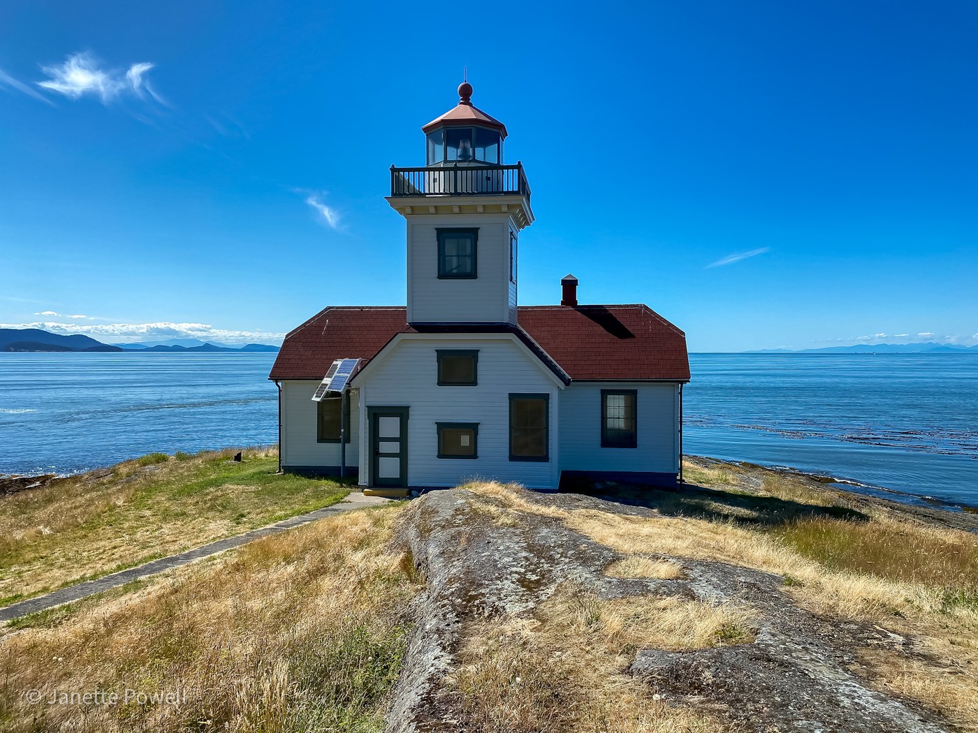
Patos Island Lighthouse. Photo by trip reporter Janette Powell.
Getting to the picturesque little lighthouse requires a bit of effort. It is accessible only by boat — and there is no dock, so you’ll have to navigate currents and land on the beach. If you don’t have your own boat, you can consider chartering a boat or taking a long kayak trip from Orcas Island. The effort is worth it, though, for a peaceful place with options for paid camping.
> Plan your trip to Pato Island Lighthouse using WTA's Hiking Guide
Turn Point Light Station
Location: Stuart Island in the San Juan Islands
Length: 6 miles, roundtrip
Elevation Gain: 280 feet
Grounds/facilities: Grounds open. Museum open Tuesday through Sunday from Fourth of July weekend through Labor Day.

The light keeper's house at Turn Point Light Station. Photo by Handyman9.
You’ll need a boat to get here, but if you can manage that, you’ll get to explore a quiet and beautiful island. There isn’t actually a lighthouse here, but rather a light station. There is also perhaps the most adorable privy you will ever see.
> Plan your trip to Turn Point Light Station using WTA's Hiking Guide
Pacific Coast
Cape Disappointment Lighthouse
Location: Long Beach area
Length: 0.6 mile, roundtrip
Elevation Gain: 150 feet
Grounds/facilities: Building closed to visitors

Cape Disappointment Lighthouse. Photo by Joey Smith.
Cape Disappointment Lighthouse is one of two at Cape Disappointment State Park. The light is still active, and is easy to access after a short walk through a lush coastal forest. You can also visit the North Head Lighthouse, which is a much shorter hike (see below).
> Plan your trip to Cape Disappointment Lighthouse using WTA's Hiking Guide
North Head Lighthouse
Location: Long Beach area
Length: 0.75 mile, roundtrip
Elevation Gain: 25 feet
Grounds/facilities: Grounds open. Lighthouse open for tours May - September.

North Head Lighthouse. Photo by trip reporter KatieJM.
North Head Lighthouse offers a stunning scene, as it perches high above the waves. You can explore the grounds, and then if you want more, there are plenty of other hiking options in the area. The short trail to the lighthouse is wheel-chair accessible.
> Plan your trip to North Head Lighthouse using WTA's Hiking Guide
Cape Flattery Lighthouse (trail will reopen march 15, 2022)
Location: Northwest corner of Olympic Peninsula
Length: 1.5 miles roundtrip
Elevation Gain: 200 feet
Grounds/facilities: No
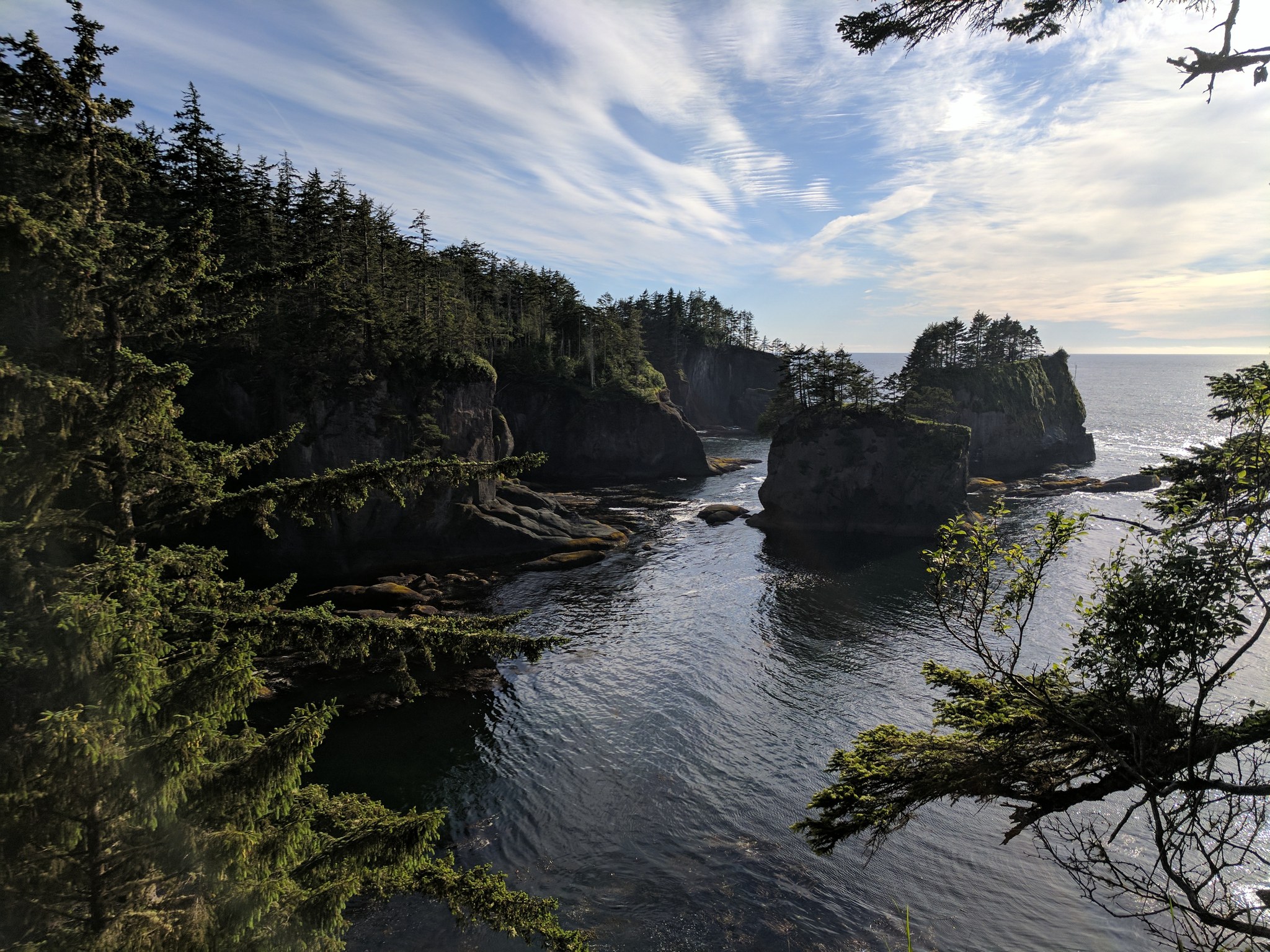
Cape Flattery Lighthouse. Photo by trip reporter gobozov.
This lighthouse is situated on scenic Tatoosh Island, off the coast of Cape Flattery. The trail offers excellent views of the light and the dramatic coastline. The Makah Tribe manages the land, and you'll want to be sure to get a permit on your way; Northwest Forest Passes and Discover Passes won't be accepted here.
> Plan your trip to Cape Flaterry Lighthouse using WTA's Hiking Guide
Grays Harbor Lighthouse
Location: Westport, on Pacific Coast
Length: 2 miles, roundtrip
Elevation Gain: 15 feet
Grounds/facilities: Grounds open, tower open during tours

Grays Harbor Lighthouse. Photo by trip reporter HGriesbach.
This ADA-accessible trail offers a lot to enjoy. Watch for birds, admire the art installed along the trail and check out interpretive signs. While you can’t see the ocean the whole way, you can always hear the soothing sounds of crashing waves. Be sure to read the interpretive signs to find out why the lighthouse is so far from the beach.
> Plan your trip to Grays Harbor Lighthouse using WTA's Hiking Guide
See a lighthouse you'd like to visit? Save the hike in your My Backpack account and you'll be able to find it easily when you're ready to go. And when you're back? Let us know how it was in a trip report.


