
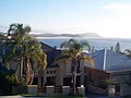
Terrigal
| Terrigal Central Coast, New South Wales | |||||||||||||||
|---|---|---|---|---|---|---|---|---|---|---|---|---|---|---|---|
 Terrigal Haven | |||||||||||||||
 Terrigal | |||||||||||||||
| Coordinates | 33°26′53″S 151°26′40″E / 33.44806°S 151.44444°E | ||||||||||||||
| Population | 12,730 (SAL 2021)[1] | ||||||||||||||
| Postcode(s) | 2260 | ||||||||||||||
| Elevation | 9 m (30 ft) | ||||||||||||||
| Area | 9.1 km2 (3.5 sq mi) | ||||||||||||||
| Location |
| ||||||||||||||
| LGA(s) | Central Coast Council | ||||||||||||||
| Parish | Kincumber | ||||||||||||||
| State electorate(s) | Terrigal | ||||||||||||||
| Federal division(s) | |||||||||||||||
| |||||||||||||||
Terrigal is a coastal town on the Central Coast of New South Wales, Australia, located 12 kilometres (7 mi) east of Gosford on the Pacific Ocean. It is part of the Central Coast Council local government area.
History
[edit]Terrigal was first settled in 1826 by European Settler John Gray, who called his property Tarrygal, after the[2] Aboriginal place name, signifying 'place of little birds'. Early industry included Sawmilling and shipbuilding by Thomas Davis, who in 1886 constructed the General Gordon which was a notable steamship that operated on the Hawkesbury River at the Haven, which at the time was known as Broxmouth Ville Common.[3][4]
Geography and climate
[edit]The town's long beach is highly popular with tourists with a large Crowne Plaza hotel. Of geographical significance are the Terrigal lagoons. There are in fact two lagoons at Terrigal, one of which has been filled in to make way for a traffic oval. A local landmark is "The Skillion", a promontory which provides a view of all Terrigal. In recent years the Skillion has undergone rehabilitation by the local city council. Other popular attractions are the numerous nearby surf schools and trails.[5]

The Skillion is on a preserved area of land known as "The Haven". The Haven is centred by a popular public oval which is home of the "Terrigal Trojans", a Rugby Union club. Their new club house was provided by the former Gosford City Council. During the summer it is used by the Terrigal Matcham Cricket Club for both senior and junior fixtures. The Haven also has a popular boat ramp which is partnered by a diving club, and a small number of restaurants and cafes (due to tight development restrictions on the area).[citation needed]

Central Coast Council has invested in Terrigal's CBD with a multi-level car park, esplanade walkway and stormwater drainage system.[citation needed] As a result of improved infrastructure and increased developer interest, Terrigal has become substantially more urban since the 1970s, when there was only one market, one medical centre and several orchards in the area.[citation needed]
Terrigal, as a popular beach-destination, is generally relatively mild to warm all year round, although can become somewhat cool during the winter months.
| Climate data for Terrigal Beach | |||||||||||||
|---|---|---|---|---|---|---|---|---|---|---|---|---|---|
| Month | Jan | Feb | Mar | Apr | May | Jun | Jul | Aug | Sep | Oct | Nov | Dec | Year |
| Mean daily maximum °C (°F) | 26.1 (79.0) |
26.0 (78.8) |
25.1 (77.2) |
22.9 (73.2) |
20.3 (68.5) |
18.0 (64.4) |
17.3 (63.1) |
18.8 (65.8) |
21.0 (69.8) |
22.7 (72.9) |
23.8 (74.8) |
24.9 (76.8) |
22.2 (72.0) |
| Mean daily minimum °C (°F) | 19.7 (67.5) |
20.0 (68.0) |
18.9 (66.0) |
15.9 (60.6) |
13.1 (55.6) |
11.1 (52.0) |
9.7 (49.5) |
10.5 (50.9) |
12.8 (55.0) |
14.8 (58.6) |
16.8 (62.2) |
18.4 (65.1) |
15.1 (59.3) |
| Source: [6] | |||||||||||||
Landmarks
[edit]Terrigal is home to a number of both natural and man-made landmarks. The Skillion is a sedimentary rock formation which was formed in the Triassic Period.[7] Not only is the Skillion a beautiful artifact, the flip-side features an extremely steep hill which is used for exercise by locals and tourists.
Terrigal Lagoon, an intermittently closed intermediate saline coastal lagoon,[8] is popular for kayaking and paddleboards.
The Terrigal Boardwalk was opened on the 14th April 2021, and was commissioned by the Central Coast Council and partially funded by the NSW Government, to much controversy.[9] The boardwalk provides a link between the Terrigal Beach, the rockpools, boatramp, and The Skillion.
Terrigal Foreshore War Memorial was redeveloped in 2019 from the combination of two older war memorials, one that historically sat near the Surf Life Saving Club, and the other was the former Erina District War Memorial which was originally on the intersection of Terrigal Drive and The Entrance Road.[10]
Demographics
[edit]According to the 2021 census, there were 12,730 people in Terrigal.
- Aboriginal and Torres Strait Islander people made up 1.9% of the population.
- 74.4% of people were born in Australia. The next most common countries of birth were England 7.0%, New Zealand 1.9%, South Africa 1.5%, and the United States of America 0.7%.
- 87.6% of people spoke only English at home; the next most common languages spoken at home included Mandarin 0.7%, Spanish 0.5%, Italian 0.4%, Portuguese 0.4%, and Afrikaans 0.3%.
- The most common responses for religion were No Religion 39.4%, Catholic 23.6%, Anglican 15.1%, and Uniting Church 2.7%; a further 5.6% of respondents for this area elected not to disclose their religious status.[11]
Amenities
[edit]Just outside the CBD lie a number of amenities: a recently re-built hotel (2006), a primary school and high school (separate campuses), Catholic school, basketball stadium (used for training by Olympic athletes in the 2000 Sydney Olympics), and a large multi-purpose oval with three fields and year-round sporting activities. A skate park was opened in 2018.[12]
In April 2011, HMAS Adelaide was scuttled off Terrigal as a dive wreck.[13]
Politics
[edit]At federal level, Terrigal is within the Division of Robertson. In the Federal election of May 2022 it was won by Gordon Reid of the Australian Labor Party, previously held for nine years by Lucy Wicks of the Liberal Party of Australia, as a result of the seat changing hands every time government changes this seat is known as a bellwether.[14]
In the New South Wales Legislative Assembly, Terrigal is within the electorate of Terrigal, currently held by Adam Crouch of the Liberal Party.[15]
Transport
[edit]Not far from the town centre are large shopping centres and M1 freeway (19 kilometres (12 mi)) linked to Sydney (south) and Newcastle (north). The town itself is served by Terrigal Drive (to the west), Scenic Highway (to the south) and Ocean View Drive to the north.
Terrigal is served by Busways routes 67 and 68 to Gosford station.[16][17]
Gallery
[edit]-
 Beachfront
 -
 Morning beach
 -
 Residential development
 -
 Local businesses


References
[edit]- ^ Australian Bureau of Statistics (28 June 2022). "Terrigal (suburb and locality)". Australian Census 2021 QuickStats. Retrieved 28 June 2022.
- ^ "Terrigal". The Sydney Morning Herald. 27 October 2008. Travel. Archived from the original on 22 July 2024.
The first European settler was John Gray who arrived in 1826 and called his property Tarrygal, after the indigenous place name, signifying 'place of little birds'.
- ^ "Shipbuilding History". Rotary Kincumber Shipbuilders Heritage Walk. Archived from the original on 30 November 2023.
One of the Davis brothers, Thomas, established his yard at Terrigal Haven, where in 1886 he built the steam paddle-wheeler, General Gordon, one of the most famous vessels to ply waters of the Hawkesbury, Broken Bay and Brisbane Water.
- ^ "Plan of Management Terrigal Haven" (PDF). Printed by Gosford City Council, 49 Mann Street Gosford NSW 2250. December 2009. Archived (PDF) from the original on 22 July 2024.
In 1870 Tom Davis, a shipbuilder and timber dealer, leased an area of 'Broxmouth Ville Common' from the government and established a sawmill and shipyard. Next to the shipyard site was a rain filled lagoon that supplied the water for the sawmill's boilers (this is now the site of the Haven Oval). A tramway ran the sawn timber, including a variety of hardwood timber, to the jetty at Cockrone Lagoon where it was shipped to various destinations. Davis employed approximately 120 men who lived on the land and was therefore the major employer of labour in the locality at the time.
- ^ "Terrigal". Destination NSW. Archived from the original on 22 July 2024. Retrieved 11 June 2013.
- ^ "Terrigal climate, averages and extreme weather record - Meat & Livestock Australia". weather.MLA.com.au. Retrieved 7 February 2018.
- ^ "The Skillion at Terrigal". www.geomaps.com.au. Retrieved 19 July 2022.
- ^ Roy, P. S; Williams, R. J; Jones, A. R; Yassini, I; et al. (2001). "Structure and Function of South-east Australian Estuaries". Estuarine, Coastal and Shelf Science. 53 (3): 351–384. doi:10.1006/ecss.2001.0796.
- ^ "Boardwalk work has officially commenced". Central Coast News. 8 May 2020. Retrieved 19 July 2022.
- ^ warmemorialsnsw (31 July 2019). "Terrigal Foreshore War Memorial". www.warmemorialsregister.nsw.gov.au. Retrieved 31 July 2023.
- ^ Australian Bureau of Statistics (28 June 2022). "Terrigal". 2021 Census QuickStats. Retrieved 22 July 2024.
- ^ Killman, Fiona (27 June 2018). "Banjo's Skate Park opens at Terrigal Reserve Lagoon". Central Coast Gosford Express Advocate. Retrieved 18 November 2023.
- ^ Home Adelaide Dive Wreck
- ^ "Profile of the electoral division of Robertson (NSW)". Australian Electoral Commission. 19 November 2019. Location Description:. Archived from the original on 22 July 2024. Retrieved 22 July 2024.
Robertson covers an area from the Hawkesbury River and Broken Bay in the south, west to Gunderman, north along the Gosford City Council Boundary to Kulnura, then east and south along the Gosford City Council boundary until it crosses the main Northern Railway Line at Lisarow. South along the main Northern Railway line to North Gosford, then east along Glennie Street, Clyde Road, Carlton Road, The Entrance Road, Ocean View Drive and Wamberal Lagoon inlet to the coast. The main towns include Erina, Gosford, Gunderman, Kulnura, Mooney Mooney, Narara, Patonga, Somersby, Terrigal and Woy Woy.
{{cite web}}: CS1 maint: extra punctuation (link) - ^ "The Legislative Assembly District of Terrigal". NSW Electoral Commission. 11 April 2024. Localities and postcodes. Archived from the original on 22 July 2024. Retrieved 22 July 2024.
Avoca Beach, Bensville, Copacabana, Daleys Point, Davistown, Empire Bay, Erina, Erina Heights, Forresters Beach, Green Point, Hardys Bay, Holgate, Killcare, Killcare Heights, Kincumber, Kincumber South, Lisarow, Macmasters Beach, Matcham, Mount Elliot, North Avoca, Picketts Valley, Pretty Beach, Saratoga, Springfield, St Huberts Island, Terrigal, Wagstaffe, Wamberal, Yattalunga.
- ^ "68 Gosford to Wamberal via Terrigal (Loop Service) - Pre 28 Jul 24". transportnsw.info. 21 July 2024. Archived from the original on 22 July 2024. Retrieved 22 July 2024.
- ^ "67 Gosford to North Avoca via Terrigal (Loop Service) - Pre 28 Jul 24". transportnsw.info. 21 July 2024. Archived from the original on 22 July 2024. Retrieved 22 July 2024.
| International | |
|---|---|
| National | |