Weather
Tropical Storm Watch Issued As Storm Jose Approaches Durham/Middlefield
The latest hyperlocal forecast for how Jose will impact parts of Connecticut.

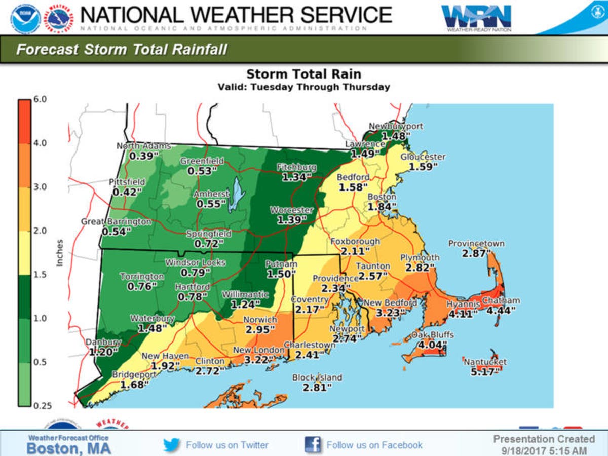
DURHAM, CT — Durham and Middlefield are under a Tropical Storm Watch as Hurricane Jose approaches. The worst impact for Connecticut will be on the immediate coast, which is under a Tropical Storm Watch, according to the National Weather Service.
For areas inland in southern Connecticut, a Hazardous Weather Outlook has been issued for “strong gusty winds and heavy rain associated with tropical cyclone Jose.” Hartford and Tolland counties are without any advisory, but they are expected to see periods of heavy rain and some gusty winds too.
The weather is expected to deteriorate in Connecticut beginning Tuesday night and into early Wednesday, which is when the wind and rain will be at its worst. Southeast Connecticut will see the greatest impacts, as it’s closest to Jose.
Find out what's happening in Durham-Middlefieldwith free, real-time updates from Patch.
Below is the forecast for the Durham area:
Find out what's happening in Durham-Middlefieldwith free, real-time updates from Patch.
Tuesday
Showers likely. Cloudy, with a high near 72. Northeast wind 11 to 14 mph. Chance of precipitation is 70%. New precipitation amounts between a half and three quarters of an inch possible.
Tuesday Night
Showers likely, mainly before 3am. Cloudy, with a low around 65. Breezy, with a north wind 17 to 24 mph. Chance of precipitation is 60%. New precipitation amounts between a quarter and half of an inch possible.
Wednesday
A 50 percent chance of showers. Mostly cloudy, with a high near 74. Windy, with a north wind 20 to 26 mph, with gusts as high as 36 mph.
Wednesday Night
A 30 percent chance of showers, mainly before 9pm. Mostly cloudy, with a low around 64. North wind 9 to 14 mph.
Image via NWS
Get more local news delivered straight to your inbox. Sign up for free Patch newsletters and alerts.