Weather
Why Remnants Of Hurricane Beryl May Mean Tornadoes In Parts Of MA
Thunderstorms — including tornadoes — and dangerous heat will be the order of the day across Massachusetts.

MASSACHUSETTS — The remnants of Hurricane Beryl — now a tropical storm — will pass to the north of Massachusetts on Wednesday, but still may bring severe weather to the state as it continues on its path.
Beryl is just one weather hazard on the radar for Wednesday. The entire state except Cape Cod and the Berkshires will be under a heat advisory for a third consecutive day, with heat indices expected between 95 and 100. The temperatures will soar even though clouds will most likely cover the skies thanks to Beryl.
The National Weather Service is predicting a marginal chance of severe thunderstorms for Massachusetts between Plymouth and the Quabbin Reservoir. But parts of western Massachusetts are at an elevated risk of severe thunderstorms, including the chance of an isolated tornado.
Find out what's happening in Across Massachusettswith free, real-time updates from Patch.
Tornadoes are often a greater risk on the lower right side of storms like Beryl, even in a weakened state.
"Tropical systems create a lot more spin in the atmosphere than your typical storm. The risk for tornadoes is naturally higher," AccuWeather Lead Hurricane Expert Alex DaSilva said in a forecast.
Find out what's happening in Across Massachusettswith free, real-time updates from Patch.
In Massachusetts, northwestern parts of the state are at higher risk due to being closer to Beryl's path.
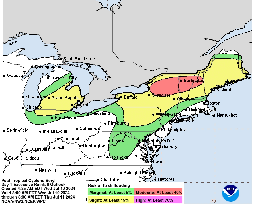
"Forcing for ascent associated with the remnant circulation is expected to trigger strong to severe thunderstorms across portions of New York and northern New England this afternoon. The risk for such storms is more marginal across southern New England, with the greatest risk across west/northwestern MA," the National Weather Service said in a Wednesday morning forecast.
Heavy rain may be the biggest risk to eastern Massachusetts, with a 1/2 inch expected between Worcester and Boston on Wednesday night and into Thursday, according to forecasts. Another inch could fall Friday into Saturday when another storm system enters the region.
Forecasters are warning residents in northern New Hampshire, Vermont and Maine to be mindful of heavy downpours and flooding with the potential for the storm to park itself over the region.
"AccuWeather meteorologists have increased concerns about flooding risks in parts of upstate New York, portions of Vermont, New Hampshire, and even Maine on Thursday. That tropical moisture from Beryl will encounter a frontal boundary in that area that can squeeze out extra rainfall," AccuWeather Chief Meteorologist Jon Porter said
Get more local news delivered straight to your inbox. Sign up for free Patch newsletters and alerts.