Home & Garden
Hazardous Weather Outlook Continues Thursday In Essex County
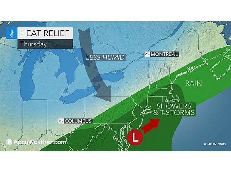
More thunderstorms are on the way to Essex County, bringing the potential for flooding, forecasters say.

A Hazardous Weather Outlook continues Thursday throughout all of New Jersey, including Essex County, the National Weather Service warns.
The National Weather Service says showers and thunderstorms producing “heavy rain” may lead to flooding in low-lying areas or locations with poor drainage across Essex County.
Rain Wednesday broke a long dry spell for the region. That precipitation will continue today, forecasters say, with thunderstorms that will push out the record-breaking temperatures that hovered throughout the area earlier in the week.
Find out what's happening in Livingstonwith free, real-time updates from Patch.
According to the Weather Channel, there is a chance for scattered thunderstorms throughout the day. The likelihood of storms increases this evening. Rain and showers are predicted through the night.
It is expected to clear out Friday morning.
Find out what's happening in Livingstonwith free, real-time updates from Patch.
“A strong cold front will impact the Northeast, bringing much-cooler air into the region,” according to AccuWeather Meteorologist Edward Vallee. “Rain and thunderstorms will drench some areas, bringing localized flooding in some low-lying and poor drainage areas.”
Forecasters say the storms will cause temperatures to go down as much as 20 degrees from the humid conditions earlier this week.
Get more local news delivered straight to your inbox. Sign up for free Patch newsletters and alerts.