Weather
Hour-By-Hour Snow Impact In Mercer County: What To Expect
Here's the impact of snow, rain and strong winds in Mercer County on Sunday.

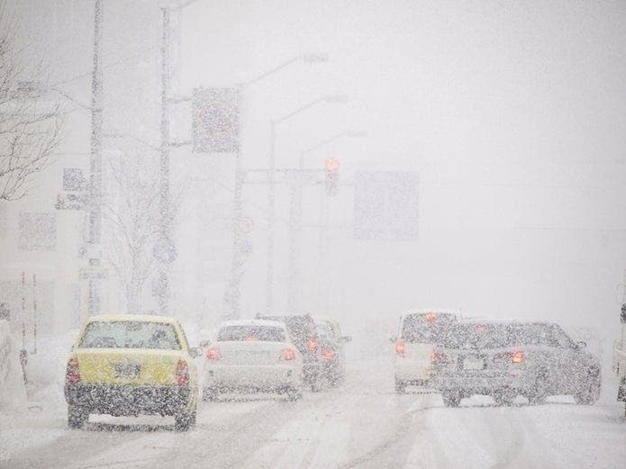
MERCER COUNTY — Winter storm warnings have been issued for Middlesex County and other areas of New Jersey that could get anywhere from 4 to 8 inches on Sunday, and highway restrictions are in place (see the expected local snow totals, timing, impacts and local predictions below).
Patch will closely monitor the weather as the state deals with accidents and other issues across New Jersey, such as ice. Read more: NJ Weather: Latest Snow Totals As More Winter Weather Possible
Patch will keep track of the snow totals every hour on Sunday. Read more: Who Got The Most Snow? NJ Town-By-Town Snow Totals
Find out what's happening in Princetonwith free, real-time updates from Patch.
Here are the alerted areas:

Snow total estimates could rise if the weather stays cold across the state. Here are the expected snow accumulations in your area:
Find out what's happening in Princetonwith free, real-time updates from Patch.
.png)
Gov. Phil Murphy closed three mega-sites in New Jersey.
VACCINE MEGA-SITE UPDATE: Due to weather forecasts, the following mega-sites will be CLOSED tomorrow: Burlington County: Appointments will be moved to 2/8, 2/9, and 2/10 Middlesex County: Appointments will be moved to 2/13 Morris County: Appointments will be moved to 2/10
— Governor Phil Murphy (@GovMurphy) February 6, 2021
Here is what to expect across the state:
- Heavy snow expected. Total snow accumulations of 4 to 8 inches
- WHEN...Until 7 p.m. on Sunday.
- IMPACTS...Travel could be very difficult particularly late Sunday morning and early Sunday afternoon.
- Snowfall rates of 1-3 inches per hour will be possible within this heavy band, and isolated snowfall totals in excess of 8 inches will be possible.
- Gale-force wind gusts are expected on the Atlantic coastal waters adjacent to Delaware and southern New Jersey on Sunday.
- Any snow that melts on Sunday afternoon will refreeze Sunday night leading to icy conditions especially on untreated roads and bridges/overpasses Monday morning
- Significant coastal flooding is not expected with this system.
Here is the timing:

New Jersey Department of Transportation Commissioner Diane Gutierrez-Scaccetti has issued a commercial vehicle travel restriction on multiple Interstate highways in New Jersey starting at 6 a.m. on Sunday.
Winter weather is expected to begin in the southern region of the state early Sunday morning and move northward, resulting in difficult driving conditions. The travel restrictions are being coordinated with neighboring states. In addition to the commercial restrictions, all motorists are strongly encouraged to stay off the roads on Sunday. The safest place to be is at home.
The commercial vehicle travel restriction will be in place for the entire length of the following highways in both directions:
- I-78, from the Pennsylvania border to I-95 (New Jersey Turnpike)
- I-80, from the Pennsylvania border to I-95 (New Jersey Turnpike)
- I-280, from I-80 to I-95 (New Jersey Turnpike)
- I-287, from NJ Route 440 to the New York State border
- NJ Route 440, from the Outerbridge Crossing to I-287
The commercial vehicle travel restriction applies to:
- Empty straight CDL-weighted trucks
- Passenger vehicles pulling trailers
- Recreational vehicles
- Motorcycles
This restriction DOES NOT apply to:
- The New Jersey Turnpike
- The Garden State Parkway
- The Atlantic City Expressway
- I-76
- I-195
- I-295
- I-676
- Public safety vehicles, sworn and civilian public safety personnel; as well as other personnel directly supporting healthcare facilities or critical infrastructure such as providing fuel or food. For a complete list of operations or personnel that are exempt from the travel ban, see the Administrative Order.
Trucks that are already in New Jersey when the travel restrictions go into place are encouraged to pull off in truck stops to wait out the storm – DO NOT PARK ON SHOULDERS.
Early Sunday morning, NJDOT will deploy its Incline Package assets on I-280 and I-78 at Jugtown mountain (between Exits 7 and 11), which includes pre-positioning towing assets, NJDOT Safety Service Patrol (SSP) trucks, and coordination with New Jersey State Police. Additional towing assets are prepositioned statewide to assist disabled vehicles to ensure Interstate and State highways remain clear for plow crews.
Here is a breakdown of snow, rain, wind speeds and temperatures for New Jersey, broken down county-by-county:
Central Jersey (Middlesex, Mercer, Union, Somerset)
SUNDAY
6 a.m.
- Temperature: 27 degrees
- Wind: 9 mph
- Rain 0.45 inches (6 a.m. to 12 p.m.)
- Snow 3.9 inches (6 a.m. to 12 p.m.)
9 a.m.
- Temperature: 31 degrees
- Wind: 11 mph
- Rain: 0.45 inches (6 a.m. to 12 p.m.)
- Snow: 3.9 inches (6 a.m. to 12 p.m.)
12 p.m.
- Temperature: 30 degrees
- Wind: 14 mph
- Rain: 0.22 inches (12 p.m. to 6 p.m.)
- Snow: 2.3 inches (12 p.m. to 6 p.m.)
3 p.m.
- Temperature: 32 degrees
- Wind: 10 mph
- Rain: 0.22 inches (12 p.m. to 6 p.m.)
- Snow: 2.3 inches (12 p.m. to 6 p.m.)
6 p.m.
- Temperature: 27 degrees
- Wind: 8 mph
- Rain: Less than an inch (6 a.m. to 12 a.m.)
- Snow: Less than an inch (6 p.m. to 12 a.m.)
9 p.m.
- Temperature: 28 degrees
- Wind: 10 mph
- Rain: Less than an inch (6 a.m. to 12 p.m.)
- Snow Less than an inch (6 a.m. to 12 p.m.)
Get more local news delivered straight to your inbox. Sign up for free Patch newsletters and alerts.