Weather
Prepare For A Big Chill, First Snow, North Hills
A prolonged cold snap finally will provide the region with opportunities for accumulating snow.

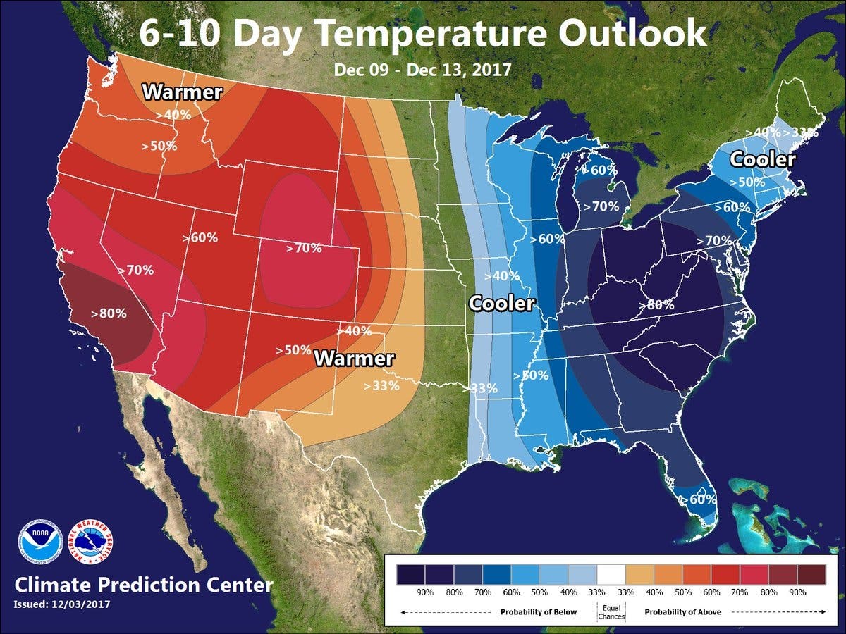
ROSS TOWNSHIP, PA - Hope you enjoyed the warm weather Monday, because an extended period of cold weather is expected to persist for the next two weeks. With the durable winter cold locked in, the National Weather Service predicts there finally will be opportunities for snow in Pennsylvania.
While the first snow of the year usually arrives in November, it’s not entirely unusual for the white stuff to hold off until December. That happens about once every four years, according to the National Oceanic and Atmospheric Administration.
Even though there’s been no snow accumulation yet in southwestern Pennsylvania, there’s still plenty of time for the region to experience typical winter snowfall patterns. Here’s what those entail, according to Current Results Weather and Science Facts:
Find out what's happening in North Hillswith free, real-time updates from Patch.
- In Pittsburgh, most days of snowfall result in less than an inch left on the ground.
- For 13 days a year on average, the amount of new snow totals at least an inch.
- Snowstorms of more than five inches in a single day happen on average about once a year.
- Major blizzards that dump 10 inches or more in one day are extremely uncommon.
- In December, there usually are eight days where there’s at least one inch of snow on the ground; three days where there are at least three inches of snow on the ground and one day in which there are at least five inches of snow on the ground.
Map via National Weather Service.
Get more local news delivered straight to your inbox. Sign up for free Patch newsletters and alerts.