

Western Wildland Environmental Threat Assessment Center
The Western Wildland Environmental Threat Assessment Center (WWETAC) is administered by the Pacific Northwest Research Station, but it covers the entire western half of the United States. WWETAC collaborates regularly with the Rocky Mountain Research Station and the Pacific Southwest Research Station, Regions 1-6 and 10, as well as with universities and other partners across the West.

Overview
Wildland ecosystems of the western United States are facing a variety of threats, including changing climatic conditions, drought, insect and disease outbreaks, invasive species, and wildfire.
At the Western Wildland Environmental Threat Assessment Center (WWETAC), we work with our partners in research and land management to:
- monitor and assess these threats
- synthesize the latest understanding of their causes and implications
- develop tools and applications to help agencies, communities, and individuals reduce negative effects and sustain natural resources

Founded in 2005 along with the Eastern Forest Environmental Threat Assessment Center, we are a unit of the USDA Forest Service. WWETAC serves all seven Forest Service regions in the western United States.
Our activities are organized into four focus areas:
Mission and Objectives
Our mission is to generate and integrate knowledge and information to provide credible prediction, early detection, and quantitative assessment of environmental threats on forests and rangelands in the western United States. WWETAC's goal is to inform policy and support the management of environmental threats to western wildlands, which include both managed lands and wilderness. Our objectives are to:
- Assess risks, uncertainties, and potential effects of environmental stresses on western ecological conditions and socioeconomic values
- Evaluate the effects and consequences of multiple, interacting stressors on western forest and rangeland health
- Provide science-based decision-support tools for policy formulation and land management in the western United States
- Provide land managers with credible predictions of potential severe disturbances in the West with sufficient warning to take preventive actions

The Future of Fire with FSim fact sheet
WWETAC researchers—in collaboration with scientists at Rocky Mountain Research Station and universities—are using FSim to explore how future fire regimes might be impacted by climate change. Learn more by exploring our new fact sheet.

This is the newest climate change vulnerability assessment (CCVA) completed by WWETAC which covers three important forests in Oregon and Washington. CCVAs provide land managers and researchers with information necessary to develop climate-informed management actions. To view more climate change vulnerability assessments, see Adaptation Partners’ external website.
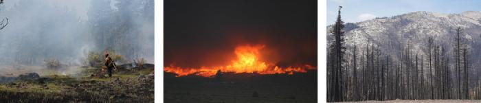
Wildfire Risk and Fuel Management
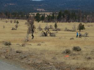
Uncharacteristically severe wildfire has become one of the biggest threats to western wildlands. As such, WWETAC has conducted wildfire modeling and prioritized research guiding pre-fire planning and post-fire management. Researchers are gathering information on wildfire behavior, drivers of megafires, and historical fire regimes on western landscapes. This information can then be used to project how fire regimes may shift with climate change, and how management may need to adapt to changing conditions.
Evaluation of plausible future community wildfire disasters in western Oregon and Washington:
This project used simulated wildfire perimeters to measure plausible community wildfire exposure and found that nearly 50 percent of western Oregon and Washington communities are vulnerable to future disasters.
Simulating the impacts of climate change on west-side fire regimes:
This project simulates wildfire behavior in western Oregon and Washington under a future climate change scenario to provide insight into the plausible range of changes in fire frequency, size, and intensity caused by climate change.
Re-evaluating historical fire regimes in west-side forests of the Pacific Northwest:
This project is developing quantitative knowledge about west-side fire history to inform managers and policy makers on adaptation to future changes in fire activity and climate.
Collaborative Postfire Research and Monitoring
This postfire research and monitoring collaboration facilitates shared stewardship by increasing interagency awareness of efforts by various state and federal natural resources agencies to assess and learn from the September 2020 fires in Oregon.

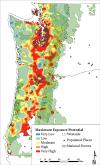
Evaluating rural Pacific Northwest towns for wildfire evacuation vulnerability:
This study leveraged a high-resolution spatial dataset of wildfire burn probability and mean fireline intensity to conduct a regional-scale screening of wildfire evacuation vulnerability for 696 rural towns in Oregon and Washington.

SoCal EcoServe: The Southern California Ecosystem Services tool (SoCal EcoServe) generates maps, graphs, and tables of pre- and post-wildfire conditions, which land managers can use to estimate environmental impacts for natural resource damage assessments and prioritize restoration activities.
MC2: MC2 simulates global vegetation response to climate change and has been used in crafting management plans for multiple forests in the West and constitute an important tool for long-term planning.
FSim: FSim fire simulator is allowing WWETAC researchers to examine how future fire regimes might change with the impacts of climate change.
ArcFuels: Arc Fuels is a quantitative wildfire risk assessment tool built to streamline fuel management planning.
Northwest Forest Threat Maps: NW Threat Maps is an interactive map covering Idaho, Montana, Oregon, Washington, and Wyoming and shows locations particularly vulnerable to a specific threat or combination of threats.
The Future of Fires with FSim fact sheet
Climate change will bring hotter and drier conditions and longer fire seasons. Understanding how fire regimes may change in the future is important for present-day management decisions. Learn how WWETAC researchers are using FSim to explore how future fire regimes might be impacted by climate change.
Publications
Publications
- Matthew J. Reilly, Aaron Zuspan, Joshua S. Halofsky, Crystal Raymond, Andy McEvoy, Alex W. Dye, Daniel C. Donato, John B. Kim, Brian E. Potter, Nathan Walker, Raymond J. Davis, Christopher J. Dunn, David M. Bell, Matthew J. Gregory, James D. Johnston, Brian J. Harvey, Jessica E. Halofsky, Becky K. Kerns. 2022. Cascadia Burning: The historic, but not historically unprecedented, 2020 wildfires in the Pacific Northwest, USA
- Zachary J. Robbins, E. Louise Loudermilk, Matthew J. Reilly, Joseph J. O'Brien, Kate Jones, Christopher T. Gerstle, Robert M. Scheller. 2022. Delayed fire mortality has long‐term ecological effects across the Southern Appalachian landscape
- Matthew J. Reilly, Steven P. Norman, Joseph J. O'Brien, E. Louise. Loudermilk. 2022. Drivers and ecological impacts of a wildfire outbreak in the southern Appalachian Mountains after decades of fire exclusion
- Matthew J. Reilly, Jessica E. Halofsky, Meg A. Krawchuk, Daniel C. Donato, Paul F. Hessburg, James D. Johnston, Andrew G. Merschel, Mark E. Swanson, Joshua S. Halofsky, Thomas A. Spies. 2021. Fire ecology and management in Pacific Northwest forests
- James M. Vose, David L. Peterson, Christopher J. Fettig, Jessica E. Halofsky, J. Kevin. Hiers, Robert E. Keane, Rachel Loehman, Michael C. Stambaugh. 2021. Fire and forests in the 21st Century: Managing resilience under changing climates and fire regimes in USA forests
- Andy McEvoy, Becky K. Kerns, John B. Kim. 2021. Hazards of risk: Identifying plausible community wildfire disasters in low-frequency fire regimes
- Alex W. Dye, John B. Kim, Andrew McEvoy, Fang Fang, Karin L. Riley. 2021. Evaluating rural Pacific Northwest towns for wildfire evacuation vulnerability

Climate Change
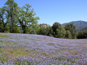
Climate change is a growing threat to western ecosystems and society. Climate change is expected to be a "threat multiplier" in that it is likely to exacerbate many existing threats to western forests and rangelands, including drought, wildfire, insect outbreaks, and invasive plants.
One of WWETAC's greatest challenges and highest priorities is translating projected climatic conditions into potential effects on western ecosystems, natural resource availability, and the societies dependent on them.
WWETAC staff and others have been systematically reviewing Western states' environmental and socioeconomic conditions in relation to how they might be negatively impacted by projected climatic changes. These vulnerability assessments can be comprehensive or resource specific. Land managers and community planners can benefit from the adaptation strategies and tactics presented in each assessment.
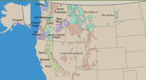
Map of regions examined through Climate Change Vulnerability Assessments by the Adaptation Partners.
Pacific Southwest Region
Intermountain Region
Pacific Northwest Region
- Columbia River Gorge, Mount Hood & Willamette National Forests
- Blue Mountains
- Oregon Coast
- South-central Oregon
- Southwest Oregon
- North Cascades
- Olympic Peninsula
- Southwest Washington
Northern Region
Southwestern Region
To view more climate change vulnerability assessments, see Adaptation Partners’ external website or the Climate Change Vulnerability Assessments Across the Nation storymap.

Carbon model assessments and improvements:
The purpose of this project is to assist managers and policymakers in selecting and running projection models to assess the impact of alternative management approaches on ecosystem and harvested wood products carbon stocks and emissions.
Simulating the impacts of climate change on west-side fire regimes:
This project simulates wildfire behavior in western Oregon and Washington under a future climate change scenario to provide insight into the plausible range of changes in fire frequency, size, and intensity caused by climate change.

PhenoMap: PhenoMap shows the "greenness" of vegetation across the conterminous United States, providing a near real-time assessment of land surface phenology using satellite imagery updated weekly.
MC2: MC2 simulates global vegetation response to climate change and has been used in crafting management plans for multiple forests in the West and constitute an important tool for long-term planning.
TACCIMO: The Template for Assessing Climate Change Impacts and Management Options (TACCIMO) is a searchable database of scientific journals and published Forest Service environmental impact analysis related to climate and climate effects.
New features and fact sheets coming soon
WWETAC Climate Change Publications
Publications
- Jessica E. Halofsky, David L. Peterson, Rebecca A. Gravenmier. 2022. Climate change vulnerability and adaptation in southwest Oregon
- Crystal Raymond, Harriet Morgan, David L. Peterson, Jessica Halofsky. 2022. A climate resilience guide for small forest landowners in Western Washington
- Alla Golub, Brent Sohngen, Yongyang Cai, John Kim, Thomas Hertel. 2022. Costs of forest carbon sequestration in the presence of climate change impacts
- John Kim, Yueyang Jiang, Linnia Hawkins, Christopher J. Still. 2022. A comparison of multiple statistically downscaled climate change datasets for the conterminous USA
- Paul Hessburg, Susan Charnley, Andrew Gray, Thomas Spies, David Peterson, Rebecca Flitcroft, Kendra Wendel, Jessica Halofsky, Eric White, John Marshall. 2021. Climate and wildfire adaptation of inland Northwest US forests
- Jessica E. Halofsky. 2021. Climate change effects in the Sierra Nevada
- Jessica E. Halofsky, David L. Peterson, Lara Y. Buluç, Jason M. Ko. 2021. Climate change vulnerability and adaptation for infrastructure and recreation in the Sierra Nevada

Invasives, Insects & Disease
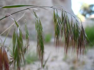
Invasive species are a threat to forests and rangelands throughout the western United States. Invasive species are those plant and insect species that are not native to the invaded ecosystem and whose introduction likely results in economic or environmental harm or reduced ecosystem integrity. WWETAC prioritizes research on the forefront of invasive species outbreaks and how to effectively manage these novel threats.
Native insects and disease can cause widescale damage and loss to western wildlands. Understanding the mechanisms behind native insect outbreaks, disease spread, and ecosystem loss is important for managing these threats. WWETAC investigates native insects and pathogens that have reached uncharacteristic or harmful levels (e.g., mountain pine beetle in the Rocky Mountains) to help land managers determine the best way to respond.
Projects coming soon

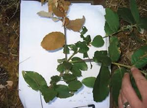
Seed Zone Mapper: The Seed Zone WebMap allows users to acquire data on seed zones that is useful in gene conservation, native plant restoration, and plant material development.
Northwest Forest Threat Maps: NW Threat Maps is an interactive map covering Idaho, Montana, Oregon, Washington, and Wyoming and shows locations particularly vulnerable to a specific threat or combination of threats.
WWETAC Invasives, Insects & Disease Publications
Publications
- Claire M. Tortorelli, John B. Kim, Nicole M. Vaillant, Karin Riley, Alex Dye, Ty C. Nietupski, Kevin C. Vogler, Rebecca Lemons, Michelle Day, Meg A. Krawchuk, Becky K. Kerns. 2023. Feeding the fire: Annual grass invasion facilitates modeled fire spread across Inland Northwest forest‐mosaic landscapes
- Emily J. Fusco, Evelyn M. Beaury, Bethany A. Bradley, Michelle Cox, Catherine S. Jarnevich, Adam L. Mahood, R. Chelsea Nagy, Ty Nietupski, Jessica E. Halofsky. 2023. The invasive plant data landscape: a synthesis of spatial data and applications for research and management in the United States
Tools
ArcFuels
WWETAC scientists developed ArcFuels, a quantitative wildfire risk assessment tool built to streamline fuel management planning. The application uses a toolbar in ArcMap that interfaces with stand- to landscape-level forest growth simulations (i.e., FVS) and a fire behavior model (i.e., FlamMap) to aid fuel treatment planning, wildfire behavior modeling, and wildfire risk assessments.
Adaptation Partners and Adaptation Library

Map of regions examined through Climate Change Vulnerability Assessments by the Adaptation Partners.
Information in the Library is derived from climate change vulnerability assessments conducted by Adaptation Partners , which collaborates with a diversity of organizations and stakeholders to develop multi-resource assessments. Adaptation options are intended to inform sustainable management of natural resources, reduce the negative effects of climate change, transition ecosystems to a warmer climate, and help integrate climate change in natural resource management, planning, and business operations of federal land management agencies. These climate change adaptation actions are organized by categories of 1) sensitivity to a particular climate change effect, 2) corresponding strategies to mitigate the impacts of this climate change effect, and 3) specific tactical actions that can take place as an implementation of that particular strategy.
Forest Plan Database (FP_DECK)
The Forest Plan Database Exchange of Current Knowledge (FP_DECK) is a searchable database of Forest Service land and resource management plans. This allows anyone to conduct a search on individual forest plans or across multiple forest plans based on a topic of interest, such as a management action, a protected resource, or a geographic location.
ForWarn II
ForWarn II provides near real-time tracking of vegetation changes across landscapes in the United States. It is useful for both monitoring disturbances and year-to-year variability. Derived products can also be used to develop insights into seasonal and inter-annual dynamics. ForWarn II was developed and is maintained by WWETAC's sister center, the Eastern Forest Environmental Threat Assessment Center.

Seed Zone Mapper

A seed zone is an area where plant materials can be transferred with little risk of being poorly adapted to their new location. The Seed Zone WebMap allows users to acquire data on seed zones that is useful in gene conservation, native plant restoration, and plant material development.
MC2
WWETAC has supported the continued refinement and application of a model called MC2, which simulates global vegetation response to climate change. MC2 can be customized for a particular region using site-specific information and used to create projections of vegetation change under future climate scenarios. It can further predict vegetative interactions with wildfire and the resulting effects on carbon stocks and water runoff. MC2 simulations have been used in crafting management plans for multiple forests in the West and constitute an important tool for long-term planning. Contact: John Kim
Northwest Forest Threat Maps
Forest Threats is an interactive map covering Idaho, Montana, Oregon, Washington, and Wyoming. The map shows locations particularly vulnerable to a specific threat or combination of threats, including development, wildfire, and insects and disease, or a combination of threats.

PhenoMap

Satellite imagery updated weekly shows the "greenness" of vegetation across the conterminous United States, providing a near real-time assessment of land surface phenology. Precipitation estimates from the National Weather Service are also displayed. PhenoMap is useful in planning a variety of natural resource activities, such as livestock grazing, seed collection, fuels assessments, and wildlife management.
Socal EcoServe
The Southern California Ecosystem Services tool (SoCal EcoServe) allows users to map, quantify, and apply monetary value to ecological benefits derived from the chaparral ecosystems of the Angeles, Cleveland, Los Padres, and San Bernardino National Forests of southern California.
TACCIMO
The Template for Assessing Climate Change Impacts and Management Options (TACCIMO) is a searchable database of scientific journals and published Forest Service environmental impact analysis related to climate and climate effects. TACCIMO serves as an ongoing repository of climate research and land management application. Contact Lisa Balduman
Key Personnel
Center Director
-
Person

Jessica Halofsky
Director of WWETAC and NWCH
Staff
-
Person

Lisa Balduman
Technical Information Specialist -
Person
Alex Dye
Faculty Research Associate -
Person

John B. Kim
Research Biological Scientist -
Person
Ellynne Kutschera
Postdoctoral Fellow -
Person
Brandon McWilliams
ORISE - Science Communication Fellow -
Person
Andrew Merschel
ORISE Postdoctoral Scholar -
Person

-
Person

Holly R. Prendeville
WWETAC & Northwest Climate Hub Coordinator -
Person
-
Person
Charlie Schrader-Patton
Geospatial Analyst/Developer -
Person
Thomas Timberlake
Natural Resource Specialist -
Person
Aaron Zuspan
ORISE Postdoctoral Fellow
Webinars
New Releases
Projects
-
Project

-
Project

-
Project

-
Project

-
Project

-
Project

-
Project
-
Project

-
Project

-
Project

-
Project
-
Project
Research Highlights
-
Research Highlight
-
Research Highlight

-
Research Highlight

-
Research Highlight
-
Research Highlight

-
Research Highlight

-
Research Highlight

-
Research Highlight
-
Research Highlight

-
Research Highlight

-
Research Highlight
Publications
- Claire M. Tortorelli, John B. Kim, Nicole M. Vaillant, Karin Riley, Alex Dye, Ty C. Nietupski, Kevin C. Vogler, Rebecca Lemons, Michelle Day, Meg A. Krawchuk, Becky K. Kerns. 2023. Feeding the fire: Annual grass invasion facilitates modeled fire spread across Inland Northwest forest‐mosaic landscapes
- Matthew J. Reilly, Aaron Zuspan, Joshua S. Halofsky, Crystal Raymond, Andy McEvoy, Alex W. Dye, Daniel C. Donato, John B. Kim, Brian E. Potter, Nathan Walker, Raymond J. Davis, Christopher J. Dunn, David M. Bell, Matthew J. Gregory, James D. Johnston, Brian J. Harvey, Jessica E. Halofsky, Becky K. Kerns. 2022. Cascadia Burning: The historic, but not historically unprecedented, 2020 wildfires in the Pacific Northwest, USA
- Jessica E. Halofsky, David L. Peterson, Rebecca A. Gravenmier. 2022. Climate change vulnerability and adaptation in southwest Oregon
- Crystal Raymond, Harriet Morgan, David L. Peterson, Jessica Halofsky. 2022. A climate resilience guide for small forest landowners in Western Washington
- Alla Golub, Brent Sohngen, Yongyang Cai, John Kim, Thomas Hertel. 2022. Costs of forest carbon sequestration in the presence of climate change impacts
- John Kim, Yueyang Jiang, Linnia Hawkins, Christopher J. Still. 2022. A comparison of multiple statistically downscaled climate change datasets for the conterminous USA
- Zachary J. Robbins, E. Louise Loudermilk, Matthew J. Reilly, Joseph J. O'Brien, Kate Jones, Christopher T. Gerstle, Robert M. Scheller. 2022. Delayed fire mortality has long‐term ecological effects across the Southern Appalachian landscape
- Matthew J. Reilly, Steven P. Norman, Joseph J. O'Brien, E. Louise. Loudermilk. 2022. Drivers and ecological impacts of a wildfire outbreak in the southern Appalachian Mountains after decades of fire exclusion
- Charlie Schrader-Patton, Nancy E. Grulke, Jacqueline P. Ott. 2021. Timing it right: Maximizing range management effectiveness with PhenoMap
- Josh McDaniel, Chuck Rhodes, Frank McCormick, Tim Fegel, Marin Chambers, Allison Rhea, Christina Burri, Jen Kovecses, Thomas Timberlake. 2021. Forests, fire, and faucets: What we are learning about lingering water quality effects of high-severity wildfires
- Paul Hessburg, Susan Charnley, Andrew Gray, Thomas Spies, David Peterson, Rebecca Flitcroft, Kendra Wendel, Jessica Halofsky, Eric White, John Marshall. 2021. Climate and wildfire adaptation of inland Northwest US forests
- Andrew G. Merschel, Peter A. Beedlow, David C. Shaw, David R. Woodruff, E. Henry Lee, Steven P. Cline, Randy L. Comeleo, R. Keala Hagmann, Matthew J. Reilly. 2021. An ecological perspective on living with fire in ponderosa pine forests of Oregon and Washington: Resistance, gone but not forgotten
- Matthew J. Reilly, Jessica E. Halofsky, Meg A. Krawchuk, Daniel C. Donato, Paul F. Hessburg, James D. Johnston, Andrew G. Merschel, Mark E. Swanson, Joshua S. Halofsky, Thomas A. Spies. 2021. Fire ecology and management in Pacific Northwest forests
- James M. Vose, David L. Peterson, Christopher J. Fettig, Jessica E. Halofsky, J. Kevin. Hiers, Robert E. Keane, Rachel Loehman, Michael C. Stambaugh. 2021. Fire and forests in the 21st Century: Managing resilience under changing climates and fire regimes in USA forests
- Jessica E. Halofsky. 2021. Climate change effects in the Sierra Nevada
- Andy McEvoy, Becky K. Kerns, John B. Kim. 2021. Hazards of risk: Identifying plausible community wildfire disasters in low-frequency fire regimes
- Jessica E. Halofsky, David L. Peterson, Lara Y. Buluç, Jason M. Ko. 2021. Climate change vulnerability and adaptation for infrastructure and recreation in the Sierra Nevada
- Charlie Schrader-Patton, Nancy Grulke, Craig Bienz. 2021. Assessment of ponderosa pine vigor using four-band aerial imagery in south central Oregon: Crown objects to landscapes
- Charlie C. Schrader-Patton, Emma C. Underwood. 2021. New biomass estimates for chaparral-dominated Southern California landscapes
- Alex W. Dye, John B. Kim, Andrew McEvoy, Fang Fang, Karin L. Riley. 2021. Evaluating rural Pacific Northwest towns for wildfire evacuation vulnerability